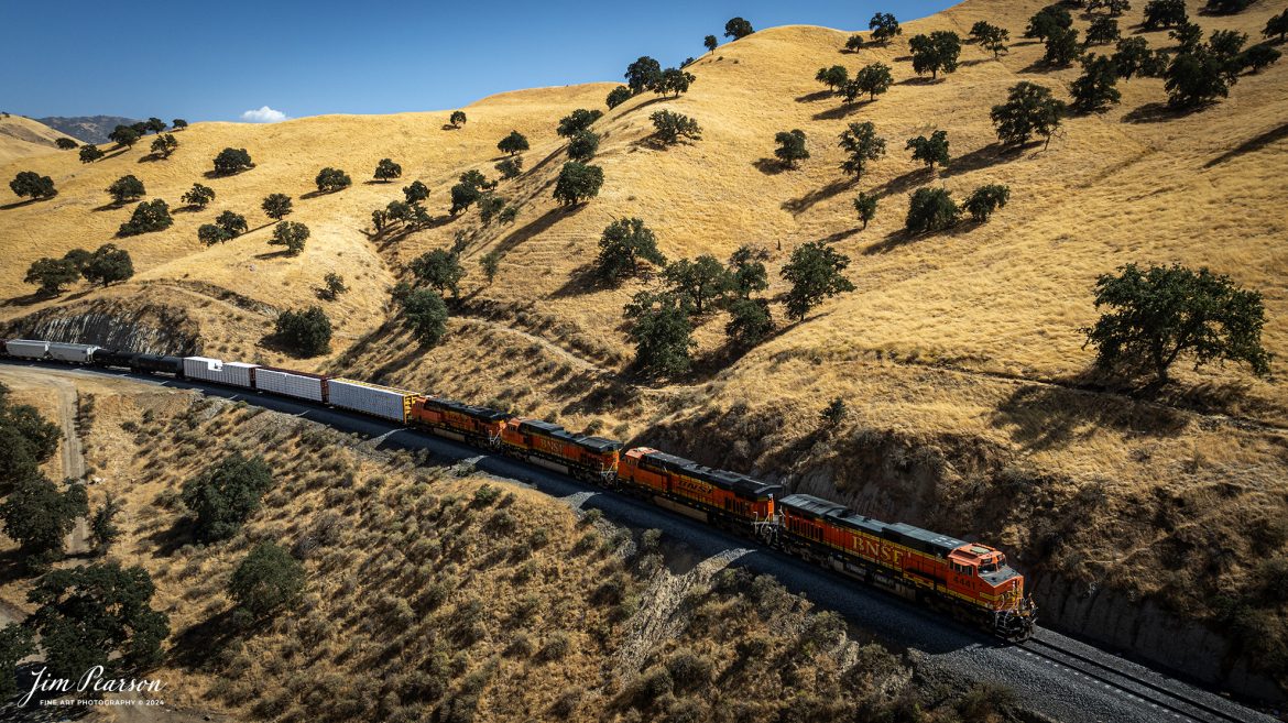
September 18th, 2024, BNSF mixed freight heads north through the mountains toward Tehachapi, California, on the Union Pacific Mojave Subdivision on a beautiful summer evening.
Tech Info: DJI Mavic 3 Classic Drone, RAW, 24mm, f/2.8, 1/1600, ISO 110.
September 18th, 2024, BNSF mixed freight heads north through the mountains toward Tehachapi, California, on the Union Pacific Mojave Subdivision on a beautiful summer evening.
Tech Info: DJI Mavic 3 Classic Drone, RAW, 24mm, f/2.8, 1/1600, ISO 110.
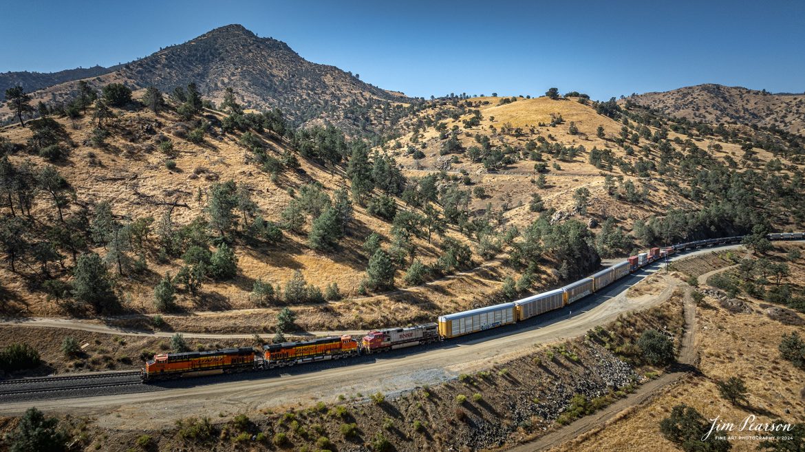
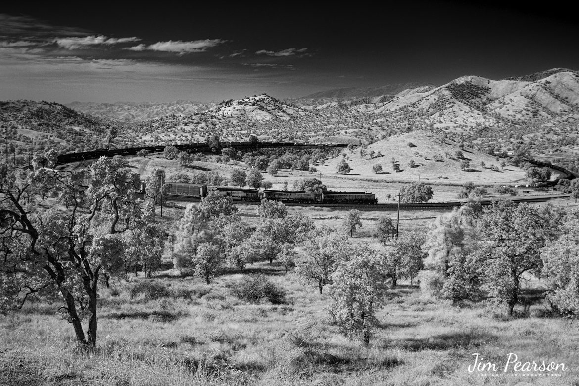
September 18th, 2024, A BNSF northbound train works its way out of the horseshoe curve on the Union Pacific Mojave Subdivision at Caliente, California, starting their climb up through the Tehachapi Pass.
According to Wikipedia: Established in the 1870s, Caliente was originally named Allens Camp for a cattle rancher and settler named Gabriel Allen. Later, the name Agua Caliente, coming from hot springs in the area, was proposed and may have been used. This name conflicted with the community of the same name in Sonoma County. With the railroad’s arrival in 1875, the shortened name Caliente was adopted.
Caliente prospered during Southern Pacific Railroad’s construction of Tehachapi Pass line. For a time, the Telegraph Stage Line and the Cerro Gordo Freighting Co. also ran through Caliente and its full-time population grew to 200. There were approximately 60 buildings, including 20 or more saloons.
Tech Info: DJI Mavic 3 Classic Drone, RAW, 24mm, f/2.8, 1/1600, ISO 100.
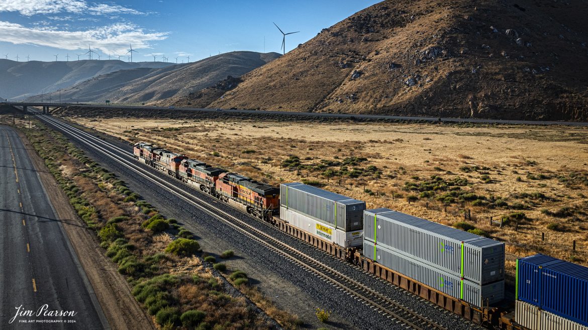
September 19th, 2024, BNSF intermodal heads north out of Tehachapi, California, on the Union Pacific Mojave Subdivision on a beautiful summer evening.
Tech Info: DJI Mavic 3 Classic Drone, RAW, 24mm, f/2.8, 1/2500, ISO 150.

September 18th, 2024, The DPU end of a BNSF northbound train prepares to pass through one of the many tunnels on the Union Pacific Mojave Subdivision at Caliente, California, during their climb up through the Tehachapi Pass.
According to Wikipedia: Established in the 1870s, Caliente was originally named Allens Camp for a cattle rancher and settler named Gabriel Allen. Later, the name Agua Caliente, coming from hot springs in the area, was proposed and may have been used. This name conflicted with the community of the same name in Sonoma County. With the railroad’s arrival in 1875, the shortened name Caliente was adopted.
Caliente prospered during Southern Pacific Railroad’s construction of Tehachapi Pass line. For a time, the Telegraph Stage Line and the Cerro Gordo Freighting Co. also ran through Caliente and its full-time population grew to 200. There were approximately 60 buildings, including 20 or more saloons.
Tech Info: DJI Mavic 3 Classic Drone, RAW, 24mm, f/2.8, 1/3200, ISO 150.

October 22, 2007 – Paducah and Louisville Railway 2111 leads the way as it exits the tunnel at Dawson Springs, Ky as it makes its way south.
According to Wikipedia: The Paducah & Louisville Railway (reporting mark PAL) is a Class II railroad that operates freight service between Paducah and Louisville, Kentucky. The line is located entirely within the Commonwealth of Kentucky. The 270-mile (430 km) line was purchased from Illinois Central Gulf Railroad in August, 1986.
Tech Info: Nikon D200, RAW, Sigma 24-70 @ 48mm, f2.8, 1/500, ISO 400.

September 18th, 2024, In this Saturday’s Infrared photo I caught BNSF 6965 leading an Northbound intermodal train past the rising moon out of Tehachapi, California.
Tech Info: Fuji XT1 converted to Infrared, RAW, Nikon 24-70, @39mm, f/4, 1/500, ISO 200.
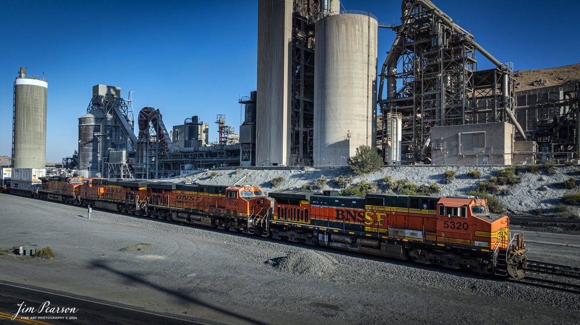
September 18th, 2024, BNSF 5320 leads a southbound freight past the cement plant in Tehachapi, California, on the Union Pacific Mojave Subdivision on a beautiful summer evening.
Tech Info: Nikon D810, RAW, Nikon 10-24 @ 12mm, f/5.6, 1/1250, ISO 100.
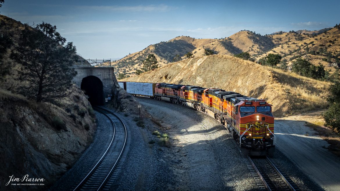
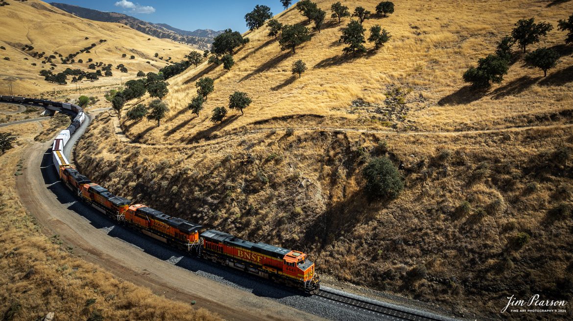
September 18th, 2024, BNSF 4441 leads an northbound freight train as they skirt around tunnel 10 from Tehachapi Loop on the Union Pacific Mojave Subdivision at, Woodford, California.
According to Wikipedia: The Tehachapi Loop is a 3,779-foot-long (0.72 mi; 1.15 km) spiral, or helix, on the Union Pacific Railroad Mojave Subdivision through Tehachapi Pass, of the Tehachapi Mountains in Kern County, south-central California. The line connects Bakersfield and the San Joaquin Valley to Mojave in the Mojave Desert.
Rising at a steady two-percent grade, the track gains 77 feet (23 m) in elevation and makes a 1,210-foot-diameter (370 m) circle. Any train that is more than 3,800 feet (1,200 m) long—about 56 boxcars—passes over itself going around the loop. At the bottom of the loop, the track passes through Tunnel 9, the ninth tunnel built as the railroad was extended from Bakersfield.
The line averages about 36 freight trains each day. Passenger trains such as Amtrak’s San Joaquin are banned from the loop, although the Coast Starlight can use it as a detour. Its frequent trains and scenic setting make the Tehachapi Loop popular with railfans. In 1998, it was named a National Historic Civil Engineering Landmark. It is also designated as California Historical Landmark #508.
One of the engineering feats of its day, the Loop was built by Southern Pacific Railroad to ease the grade over Tehachapi Pass. Construction began in 1874, and the line opened in 1876.
Tech Info: DJI Mavic 3 Classic Drone, RAW, 24mm, f/2.8, 1/1600, ISO 290.
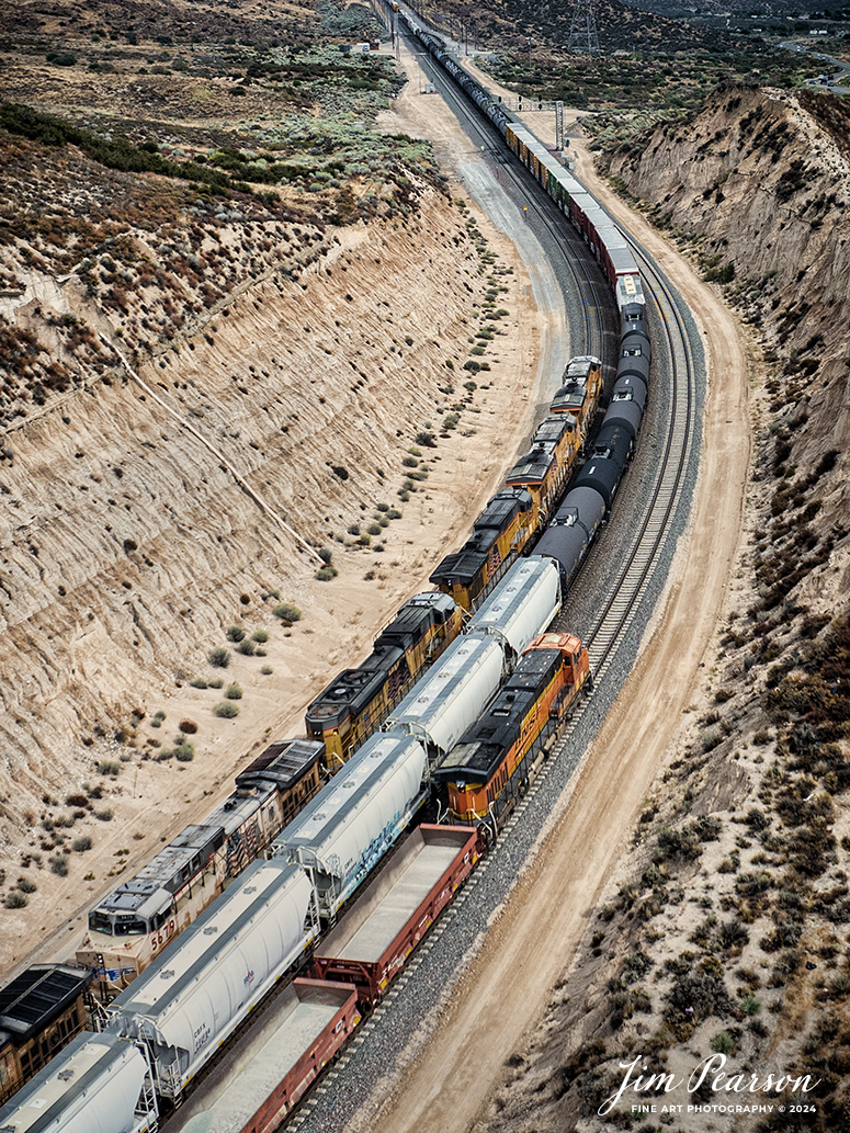
September 18th, 2024, A BNSF northbound train works its way out of the horseshoe curve on the Union Pacific Mojave Subdivision at Caliente, California, starting their climb up through the Tehachapi Pass.
According to Wikipedia: Established in the 1870s, Caliente was originally named Allens Camp for a cattle rancher and settler named Gabriel Allen. Later, the name Agua Caliente, coming from hot springs in the area, was proposed and may have been used. This name conflicted with the community of the same name in Sonoma County. With the railroad’s arrival in 1875, the shortened name Caliente was adopted.
Caliente prospered during Southern Pacific Railroad’s construction of Tehachapi Pass line. For a time, the Telegraph Stage Line and the Cerro Gordo Freighting Co. also ran through Caliente and its full-time population grew to 200. There were approximately 60 buildings, including 20 or more saloons.
Tech Info: DJI Mavic 3 Classic Drone, RAW, 24mm, f/2.8, 1/1600, ISO 100.

September 18th, 2024, Union Pacific 7995 leads a westbound freight past the cement plant in Tehachapi, California, on the Union Pacific Mojave Subdivision on a beautiful summer evening.
Tech Info: Nikon D810, RAW, Nikon 70-300 @ 300mm, f/5.6, 1/640, ISO 140.

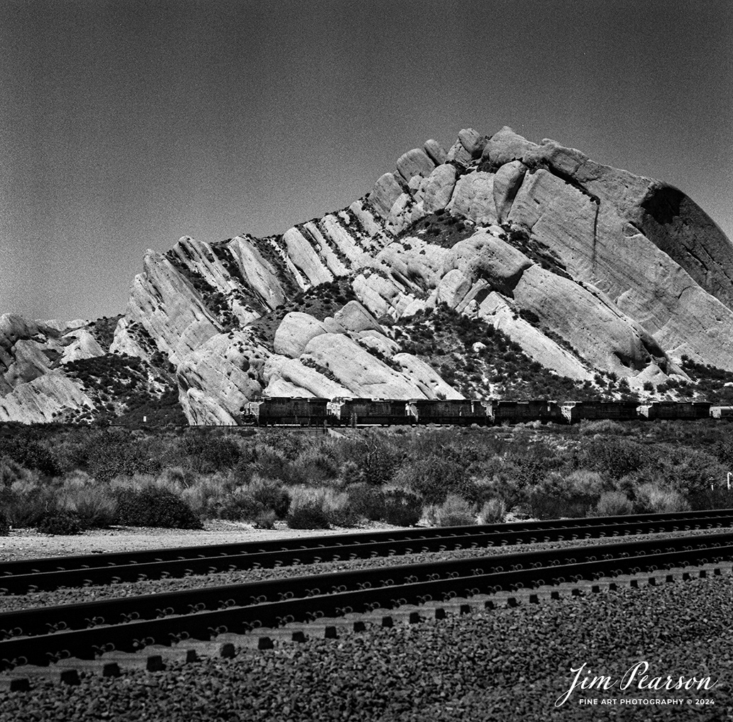
Analog Wednesday – I’ve recently added a like new Mamiya C330 Professional 2 ¼ square film camera to my camera bag and on Wednesday’s I’ll be sharing images I’ve shot with it. This shot is from September 19th, 2024, of two Westbound intermodals racing each other as they head out of Mojave, CA toward Bakersfield, CA through the Tehachapi Pass.
Tech Info: Mamiya C330 Professional, Ilford HP5 Film, Mamiya 80mm, f/4, 1/250, ISO 400.

Analog Wednesday – I’ve recently added a like new Mamiya C330 Professional 2 ¼ square film camera to my camera bag and on Wednesday’s I’ll be sharing images I’ve shot with it. This shot is from September 24th, 2024, of a Westbound BNSF intermodal as it starts its downhill run from the summit in Cajon Pass, CA.
Tech Info: Mamiya C330 Professional, Ilford HP5 Film, Mamiya 80mm, f/4, 1/400, ISO 400.
Analog Wednesday – I’ve recently added a like new Mamiya C330 Professional 2 ¼ square film camera to my camera bag and on Wednesday’s I’ll be sharing images I’ve shot with it. This shot is from September 24th, 2024, of a Westbound Union Pacific freight with six units leading through Mormon Rocks as it heads downhill in Cajon Pass, CA.
Tech Info: Mamiya C330 Professional, Ilford HP5 Film, Mamiya 80mm, f/4, 1/250, ISO 400.
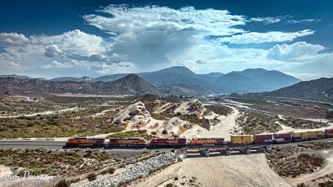
September 20th, 2024, Today I had the good fortune of catching a three way meet between a Union Pacific Freight, a BNSF freight and a BNSF rock train at the Summit of Cajon Pass in southern California and the BNSF Cajon Subdivision as Hwy 138 and the tracks head into stormy weather.
According to Wikipedia: Cajon Pass is a mountain pass between the San Bernardino Mountains to the east and the San Gabriel Mountains to the west in Southern California. Created by the movements of the San Andreas Fault, it has an elevation of 3,777 ft (1,151 m). Located in the Mojave Desert, the pass is an important link from the Greater San Bernardino Area to the Victor Valley, and northeast to Las Vegas. The Cajon Pass area is on the Pacific Crest Trail.
Cajon Pass is at the head of Horsethief Canyon, traversed by California State Route 138 (SR 138) and railroad tracks owned by BNSF Railway and Union Pacific Railroad. Improvements in 1972 reduced the railroad’s maximum elevation from about 3,829 to 3,777 feet while reducing curvature. Interstate 15 does not traverse Cajon Pass, but rather the nearby Cajon Summit. The entire area, Cajon Pass and Cajon Summit, is often referred to as Cajon Pass, but a distinction is made between Cajon Pass and Cajon Summit.
The California Southern Railroad, a subsidiary of the Atchison, Topeka and Santa Fe Railway, was the first railroad through Cajon Pass. The line through the pass was built in the early 1880s to connect the present-day cities of Barstow and San Diego. Today the Union Pacific Railroad and BNSF Railway (the successor to the Santa Fe) use the pass to reach Los Angeles and San Bernardino as part of the Southern Transcon. Due to the many trains, scenery and easy access, it is a popular location for railfans, and many photographs of trains on Cajon Pass appear in books and magazines.
The Union Pacific Railroad owns one track through the pass, on the previous Southern Pacific Railroad Palmdale cutoff, opened in 1967. The BNSF Railway owns two tracks and began to operate a third main track in the summer of 2008. The railroads share track rights through the pass ever since the Union Pacific gained track rights on the Santa Fe portion negotiated under the original Los Angeles and Salt Lake Railroad.
Tech Info: DJI Mavic 3 Classic Drone, RAW, 24mm, f/2.8, 1/1250, ISO 100.
BNSF 4037, 4549, CP 8125 and BNSF 5733 lead an eastbound intermodal at Phelan, CA, as they cross the dry wash east of Hwy 138 in the Cajon Pass on September 20th, 2024, on the BNSF Cajon Subdivision.
According to Wikipedia: Cajon Pass is a mountain pass between the San Bernardino Mountains to the east and the San Gabriel Mountains to the west in Southern California. Created by the movements of the San Andreas Fault, it has an elevation of 3,777 ft (1,151 m). Located in the Mojave Desert, the pass is an important link from the Greater San Bernardino Area to the Victor Valley, and northeast to Las Vegas. The Cajon Pass area is on the Pacific Crest Trail.
Cajon Pass is at the head of Horsethief Canyon, traversed by California State Route 138 (SR 138) and railroad tracks owned by BNSF Railway and Union Pacific Railroad. Improvements in 1972 reduced the railroad’s maximum elevation from about 3,829 to 3,777 feet while reducing curvature. Interstate 15 does not traverse Cajon Pass, but rather the nearby Cajon Summit. The entire area, Cajon Pass and Cajon Summit, is often referred to as Cajon Pass, but a distinction is made between Cajon Pass and Cajon Summit.
The California Southern Railroad, a subsidiary of the Atchison, Topeka and Santa Fe Railway, was the first railroad through Cajon Pass. The line through the pass was built in the early 1880s to connect the present-day cities of Barstow and San Diego. Today the Union Pacific Railroad and BNSF Railway (the successor to the Santa Fe) use the pass to reach Los Angeles and San Bernardino as part of the Southern Transcon. Due to the many trains, scenery and easy access, it is a popular location for railfans, and many photographs of trains on Cajon Pass appear in books and magazines.
The Union Pacific Railroad owns one track through the pass, on the previous Southern Pacific Railroad Palmdale cutoff, opened in 1967. The BNSF Railway owns two tracks and began to operate a third main track in the summer of 2008. The railroads share track rights through the pass ever since the Union Pacific gained track rights on the Santa Fe portion negotiated under the original Los Angeles and Salt Lake Railroad.
Tech Info: DJI Mavic 3 Classic Drone, RAW, 24mm, f/2.8, 1/4000, ISO 140.
September 18th, 2024, BNSF 7115, 9128 and Ferromex 4050 lead an westbound train next to tunnel 10, as they wait for an eastbound intermodal to clear Tehachapi Loop on the Union Pacific Mojave Subdivision at Keene, California.
According to Wikipedia: The Tehachapi Loop is a 3,779-foot-long (0.72 mi; 1.15 km) spiral, or helix, on the Union Pacific Railroad Mojave Subdivision through Tehachapi Pass, of the Tehachapi Mountains in Kern County, south-central California. The line connects Bakersfield and the San Joaquin Valley to Mojave in the Mojave Desert.
Rising at a steady two-percent grade, the track gains 77 feet (23 m) in elevation and makes a 1,210-foot-diameter (370 m) circle. Any train that is more than 3,800 feet (1,200 m) long—about 56 boxcars—passes over itself going around the loop. At the bottom of the loop, the track passes through Tunnel 9, the ninth tunnel built as the railroad was extended from Bakersfield.
The line averages about 36 freight trains each day. Passenger trains such as Amtrak’s San Joaquin are banned from the loop, although the Coast Starlight can use it as a detour. Its frequent trains and scenic setting make the Tehachapi Loop popular with railfans. In 1998, it was named a National Historic Civil Engineering Landmark. It is also designated as California Historical Landmark #508.
One of the engineering feats of its day, the Loop was built by Southern Pacific Railroad to ease the grade over Tehachapi Pass. Construction began in 1874, and the line opened in 1876.
Tech Info: DJI Mavic 3 Classic Drone, RAW, 24mm, f/2.8, 1/2500, ISO 100.
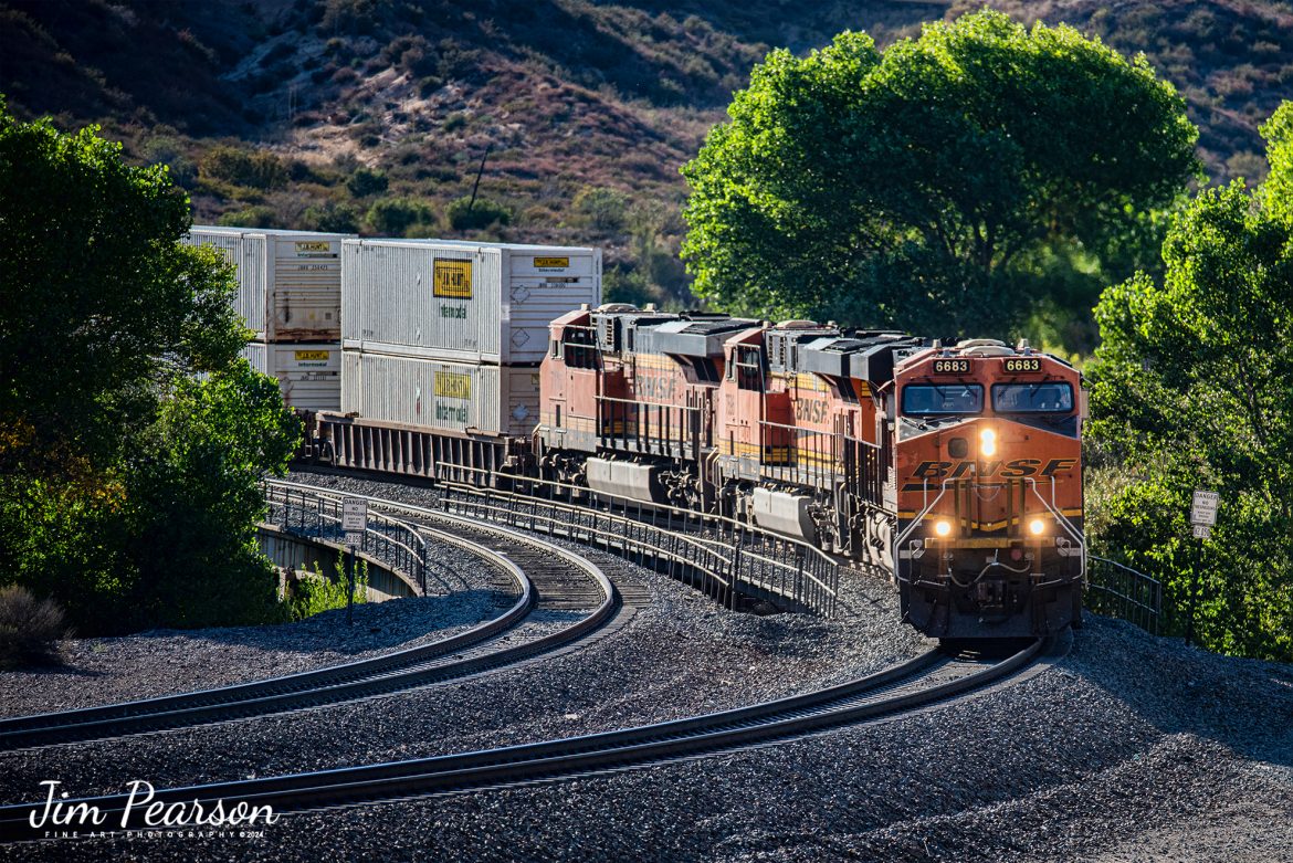
BNSF 6683 leads an westbound intermodal as it rounds a curve coming down hill in the Cajon Pass at Cajon, California on the BNSF Cajon Subdivision, on September 24th, 2024.
According to Wikipedia: Cajon Pass is a mountain pass between the San Bernardino Mountains to the east and the San Gabriel Mountains to the west in Southern California. Created by the movements of the San Andreas Fault, it has an elevation of 3,777 ft (1,151 m). Located in the Mojave Desert, the pass is an important link from the Greater San Bernardino Area to the Victor Valley, and northeast to Las Vegas. The Cajon Pass area is on the Pacific Crest Trail.
Cajon Pass is at the head of Horsethief Canyon, traversed by California State Route 138 (SR 138) and railroad tracks owned by BNSF Railway and Union Pacific Railroad. Improvements in 1972 reduced the railroad’s maximum elevation from about 3,829 to 3,777 feet while reducing curvature. Interstate 15 does not traverse Cajon Pass, but rather the nearby Cajon Summit. The entire area, Cajon Pass and Cajon Summit, is often referred to as Cajon Pass, but a distinction is made between Cajon Pass and Cajon Summit.
The California Southern Railroad, a subsidiary of the Atchison, Topeka and Santa Fe Railway, was the first railroad through Cajon Pass. The line through the pass was built in the early 1880s to connect the present-day cities of Barstow and San Diego. Today the Union Pacific Railroad and BNSF Railway (the successor to the Santa Fe) use the pass to reach Los Angeles and San Bernardino as part of the Southern Transcon. Due to the many trains, scenery and easy access, it is a popular location for railfans, and many photographs of trains on Cajon Pass appear in books and magazines.
The Union Pacific Railroad owns one track through the pass, on the previous Southern Pacific Railroad Palmdale cutoff, opened in 1967. The BNSF Railway owns two tracks and began to operate a third main track in the summer of 2008. The railroads share track rights through the pass ever since the Union Pacific gained track rights on the Santa Fe portion negotiated under the original Los Angeles and Salt Lake Railroad.
Tech Info: Nikon D810, RAW, Nikon 70-300 @ 220mm, f/5.6, 1/800, ISO 280.

I didn’t have a clue that Union Pacific 1989, Rio Grande Heritage Unit, was leading this eastbound freight until it appeared from behind Mormon Rocks in the Cajon Pass on September 24th, 2024.
I was set up on the BNSF double track below the UP line as there was another BNSF train approaching there. I had to scramble and switch from the video I was planning to shoot and pull up my D810 with the 70-300mm on it to grab this and a couple other shots before it disappeared behind brush and hillside. I would have much rather had it coming out of Mormon Rocks, but it wasn’t meant to be, I guess.
According to the Union Pacific Website: Incorporating historic colors and graphic elements of the Denver & Rio Grande Western Railroad, No. 1989 pays tribute to the men and women of the railroad who “went everywhere the hard way.”
Founded by Gen. William J. Palmer, a Union veteran of the Civil War, the Rio Grande started building a narrow-gauge line south from Denver in 1871 toward Mexico. At its peak mileage in 1917, the Rio Grande was operating nearly 6,000 miles of track.
On-line coal, bridge traffic with friendly connections, and the opening of the 6.2-mile Moffat Tunnel in 1928 that dramatically shortened its Denver-Salt Lake Route, the Rio Grande became known for its competitive spirit and mountain scenery. The “Grand Canyon of the Arkansas River,” known as the Royal Gorge, was one of the highlights on the route through the Rockies when The Denver & Rio Grande was known as the Scenic Line of the World.
Rio Grande Industries purchased Southern Pacific Lines on Sept. 12, 1988, and combined the systems on Oct. 13, 1988, operating under the name Southern Pacific. Union Pacific and Southern Pacific merged on Sept. 11, 1996.
According to Wikipedia: The Union Pacific Railroad owns one track through the pass, on the previous Southern Pacific Railroad Palmdale cutoff, opened in 1967. The BNSF Railway owns two tracks and began to operate a third main track in the summer of 2008. The railroads share track rights through the pass ever since the Union Pacific gained track rights on the Santa Fe portion negotiated under the original Los Angeles and Salt Lake Railroad.
Tech Info: Nikon D810, RAW, Nikon 70-300 @ 175mm, f/5.3, 1/800, ISO 100.
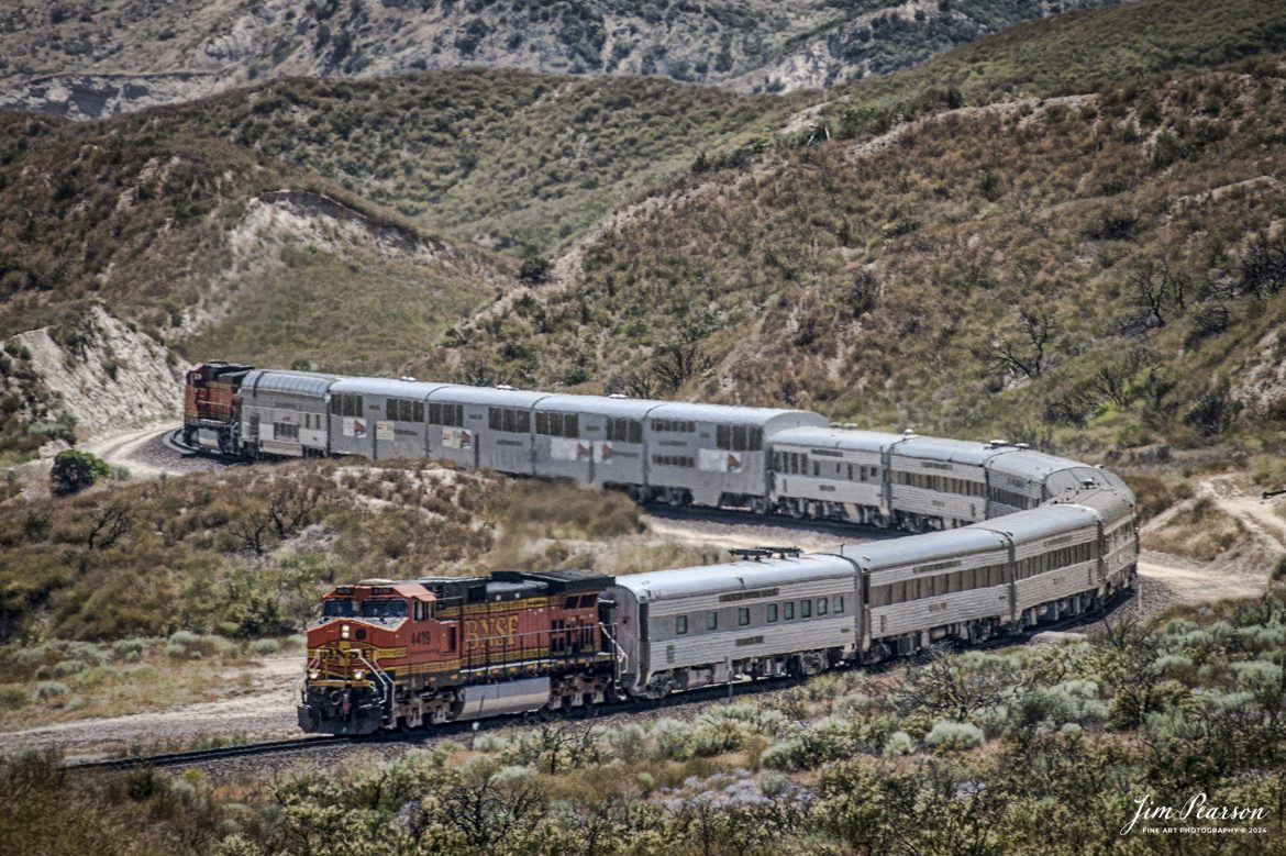
June 6, 2006 – BNSF 4419 leads a business train east bound through the Cajon Pass in southern California, headed to Barstow, CA.
According to Wikipedia: Cajon Pass is a mountain pass between the San Bernardino Mountains to the east and the San Gabriel Mountains to the west in Southern California. Created by the movements of the San Andreas Fault, it has an elevation of 3,777 ft (1,151 m). Located in the Mojave Desert, the pass is an important link from the Greater San Bernardino Area to the Victor Valley, and northeast to Las Vegas. The Cajon Pass area is on the Pacific Crest Trail.
Cajon Pass is at the head of Horsethief Canyon, traversed by California State Route 138 (SR 138) and railroad tracks owned by BNSF Railway and Union Pacific Railroad. Improvements in 1972 reduced the railroad’s maximum elevation from about 3,829 to 3,777 feet while reducing curvature. Interstate 15 does not traverse Cajon Pass, but rather the nearby Cajon Summit. The entire area, Cajon Pass and Cajon Summit, is often referred to as Cajon Pass, but a distinction is made between Cajon Pass and Cajon Summit.
The California Southern Railroad, a subsidiary of the Atchison, Topeka and Santa Fe Railway, was the first railroad through Cajon Pass. The line through the pass was built in the early 1880s to connect the present-day cities of Barstow and San Diego. Today the Union Pacific Railroad and BNSF Railway (the successor to the Santa Fe) use the pass to reach Los Angeles and San Bernardino as part of the Southern Transcon. Due to the many trains, scenery and easy access, it is a popular location for railfans, and many photographs of trains on Cajon Pass appear in books and magazines.
Tech Info: Nikon D200, RAW, Nikon 70-300 @ 200mm, f/6.3, 1/400, ISO 100.

A Union Pacific freight makes its way west down the Cajon Pass as it approaches the Mormon Rocks area in Cajon Pass, California on September 20th, 2024.
According to Wikipedia: Cajon Pass is a mountain pass between the San Bernardino Mountains to the east and the San Gabriel Mountains to the west in Southern California. Created by the movements of the San Andreas Fault, it has an elevation of 3,777 ft (1,151 m). Located in the Mojave Desert, the pass is an important link from the Greater San Bernardino Area to the Victor Valley, and northeast to Las Vegas. The Cajon Pass area is on the Pacific Crest Trail.
Cajon Pass is at the head of Horsethief Canyon, traversed by California State Route 138 (SR 138) and railroad tracks owned by BNSF Railway and Union Pacific Railroad. Improvements in 1972 reduced the railroad’s maximum elevation from about 3,829 to 3,777 feet while reducing curvature. Interstate 15 does not traverse Cajon Pass, but rather the nearby Cajon Summit. The entire area, Cajon Pass and Cajon Summit, is often referred to as Cajon Pass, but a distinction is made between Cajon Pass and Cajon Summit.
The California Southern Railroad, a subsidiary of the Atchison, Topeka and Santa Fe Railway, was the first railroad through Cajon Pass. The line through the pass was built in the early 1880s to connect the present-day cities of Barstow and San Diego. Today the Union Pacific Railroad and BNSF Railway (the successor to the Santa Fe) use the pass to reach Los Angeles and San Bernardino as part of the Southern Transcon. Due to the many trains, scenery and easy access, it is a popular location for railfans, and many photographs of trains on Cajon Pass appear in books and magazines.
The Union Pacific Railroad owns one track through the pass, on the previous Southern Pacific Railroad Palmdale cutoff, opened in 1967. The BNSF Railway owns two tracks and began to operate a third main track in the summer of 2008. The railroads share track rights through the pass ever since the Union Pacific gained track rights on the Santa Fe portion negotiated under the original Los Angeles and Salt Lake Railroad.
Tech Info: DJI Mavic 3 Classic Drone, RAW, 24mm, f/2.8, 1/2000, ISO 100.
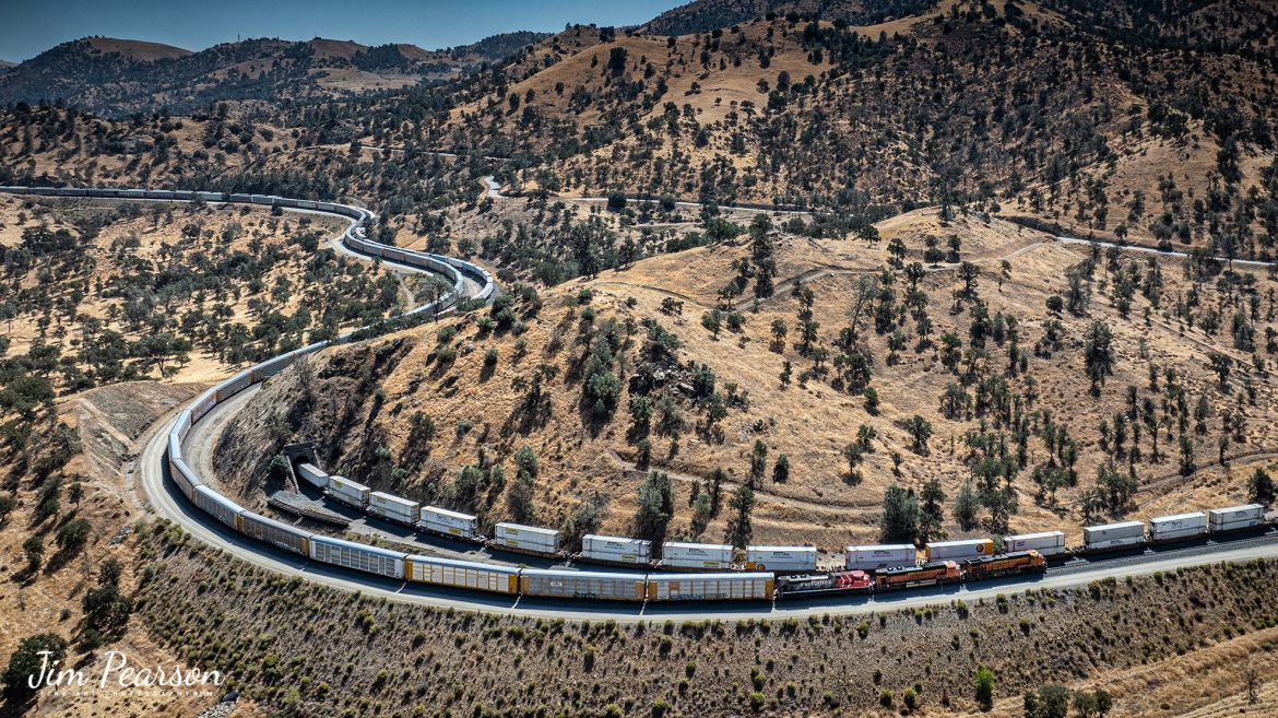
In this Saturday’s Infrared photo I caught BNSF 7904, 7853 and 2167 leading an eastbound train through the famous Tehachapi Loop on the Union Pacific Mojave Subdivision at Keene, California, on September 18th, 2024.
According to Wikipedia: The Tehachapi Loop is a 3,779-foot-long (0.72 mi; 1.15 km) spiral, or helix, on the Union Pacific Railroad Mojave Subdivision through Tehachapi Pass, of the Tehachapi Mountains in Kern County, south-central California. The line connects Bakersfield and the San Joaquin Valley to Mojave in the Mojave Desert.
Rising at a steady two-percent grade, the track gains 77 feet (23 m) in elevation and makes a 1,210-foot-diameter (370 m) circle. Any train that is more than 3,800 feet (1,200 m) long—about 56 boxcars—passes over itself going around the loop. At the bottom of the loop, the track passes through Tunnel 9, the ninth tunnel built as the railroad was extended from Bakersfield.
The line averages about 36 freight trains each day. Passenger trains such as Amtrak’s San Joaquin are banned from the loop, although the Coast Starlight can use it as a detour. Its frequent trains and scenic setting make the Tehachapi Loop popular with railfans. In 1998, it was named a National Historic Civil Engineering Landmark. It is also designated as California Historical Landmark #508.
One of the engineering feats of its day, the Loop was built by Southern Pacific Railroad to ease the grade over Tehachapi Pass. Construction began in 1874, and the line opened in 1876.
Tech Info: Fuji XT1 converted to Infrared, RAW, Nikon 24-70, @24mm, f/4, 1/1000, ISO 100.