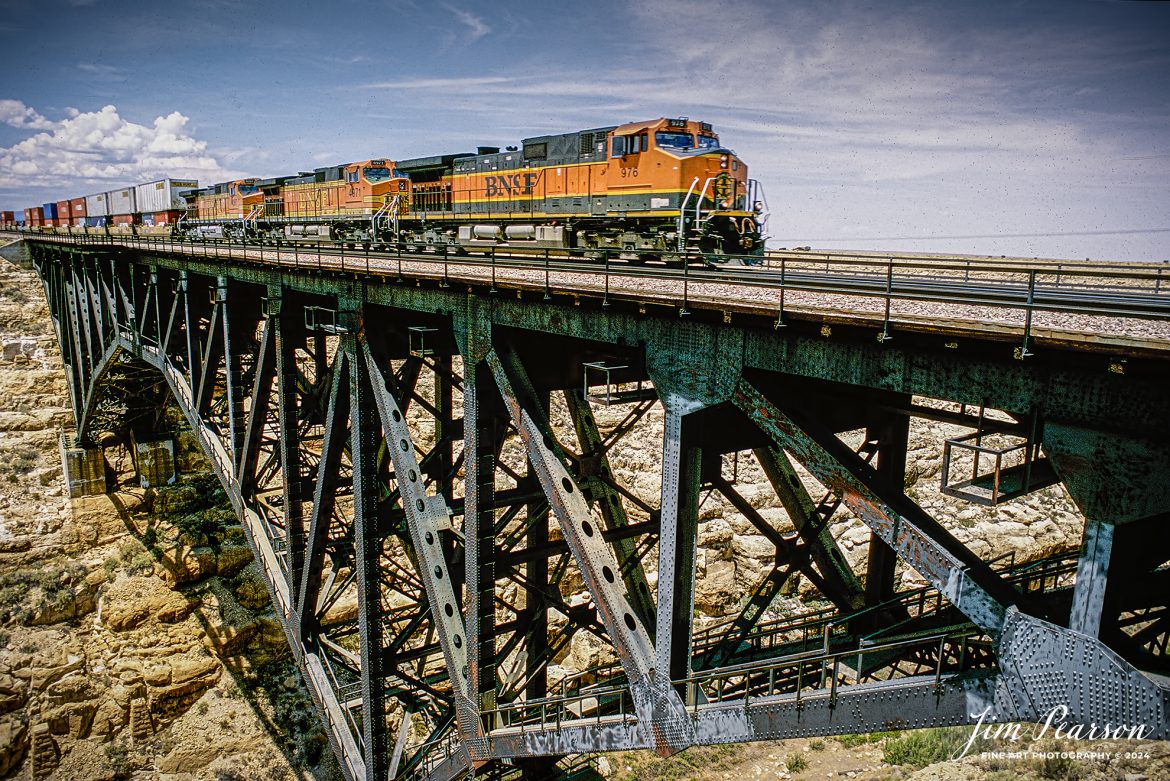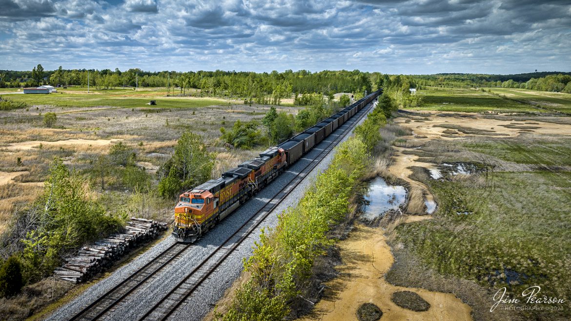
![Film Wednesday – Five Santa Fe Warbonnet units lead a loaded intermodal as it approaches one of the many tunnels in the Tehachapi mountains of California that was shot sometime in the mid 1990’s.
According to Wikipedia: The Atchison, Topeka and Santa Fe Railway (reporting mark ATSF), often referred to as the Santa Fe or AT&SF, was one of the largest Class 1 railroads in the United States between 1859 and 1996.
The Santa Fe was a pioneer in intermodal freight transport; at various times, it operated an airline, the short-lived Santa Fe Skyway, and the Santa Fe Railroad tugboats.[2] Its bus line extended passenger transportation to areas not accessible by rail, and ferryboats on the San Francisco Bay allowed travelers to complete their westward journeys to the Pacific Ocean. The AT&SF was the subject of a popular song, Harry Warren and Johnny Mercer's "On the Atchison, Topeka and the Santa Fe", written for the film The Harvey Girls (1946).
The railroad officially ceased independent operations on December 31, 1996, when it merged with the Burlington Northern Railroad to form the Burlington Northern and Santa Fe Railway.
Tech Info: Camera, Nikon F3, Kodachrome Slide Film, no other data recorded
#slidescan #filmphotography #trains #railroads #jimpearsonphotography](https://www.jimpearsonphotography.com/wp-content/uploads/2025/01/WEB-1995-KR-Slide-SF-in-Techachapi-1-1170x748.jpg)
Film Wednesday – Five Santa Fe Warbonnet units lead a loaded intermodal as it approaches one of the many tunnels in the Tehachapi mountains of California that was shot sometime in the mid 1990’s.
According to Wikipedia: The Atchison, Topeka and Santa Fe Railway (reporting mark ATSF), often referred to as the Santa Fe or AT&SF, was one of the largest Class 1 railroads in the United States between 1859 and 1996.
The Santa Fe was a pioneer in intermodal freight transport; at various times, it operated an airline, the short-lived Santa Fe Skyway, and the Santa Fe Railroad tugboats.[2] Its bus line extended passenger transportation to areas not accessible by rail, and ferryboats on the San Francisco Bay allowed travelers to complete their westward journeys to the Pacific Ocean. The AT&SF was the subject of a popular song, Harry Warren and Johnny Mercer’s “On the Atchison, Topeka and the Santa Fe”, written for the film The Harvey Girls (1946).
The railroad officially ceased independent operations on December 31, 1996, when it merged with the Burlington Northern Railroad to form the Burlington Northern and Santa Fe Railway.
Tech Info: Camera, Nikon F3, Kodachrome Slide Film, no other data recorded
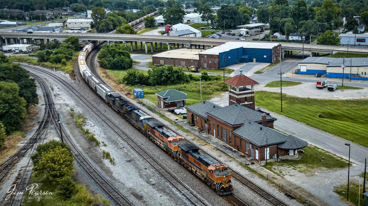
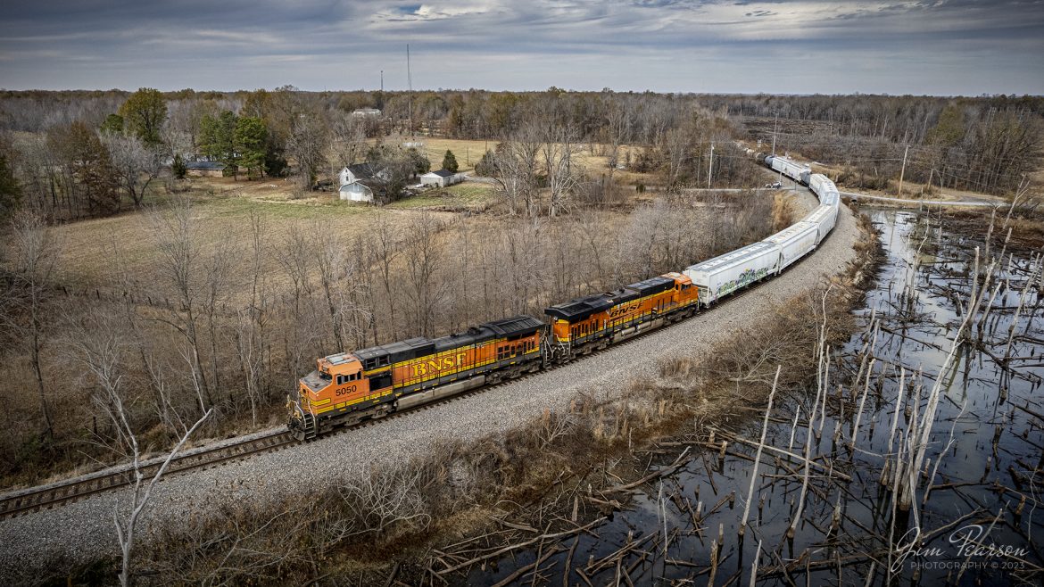
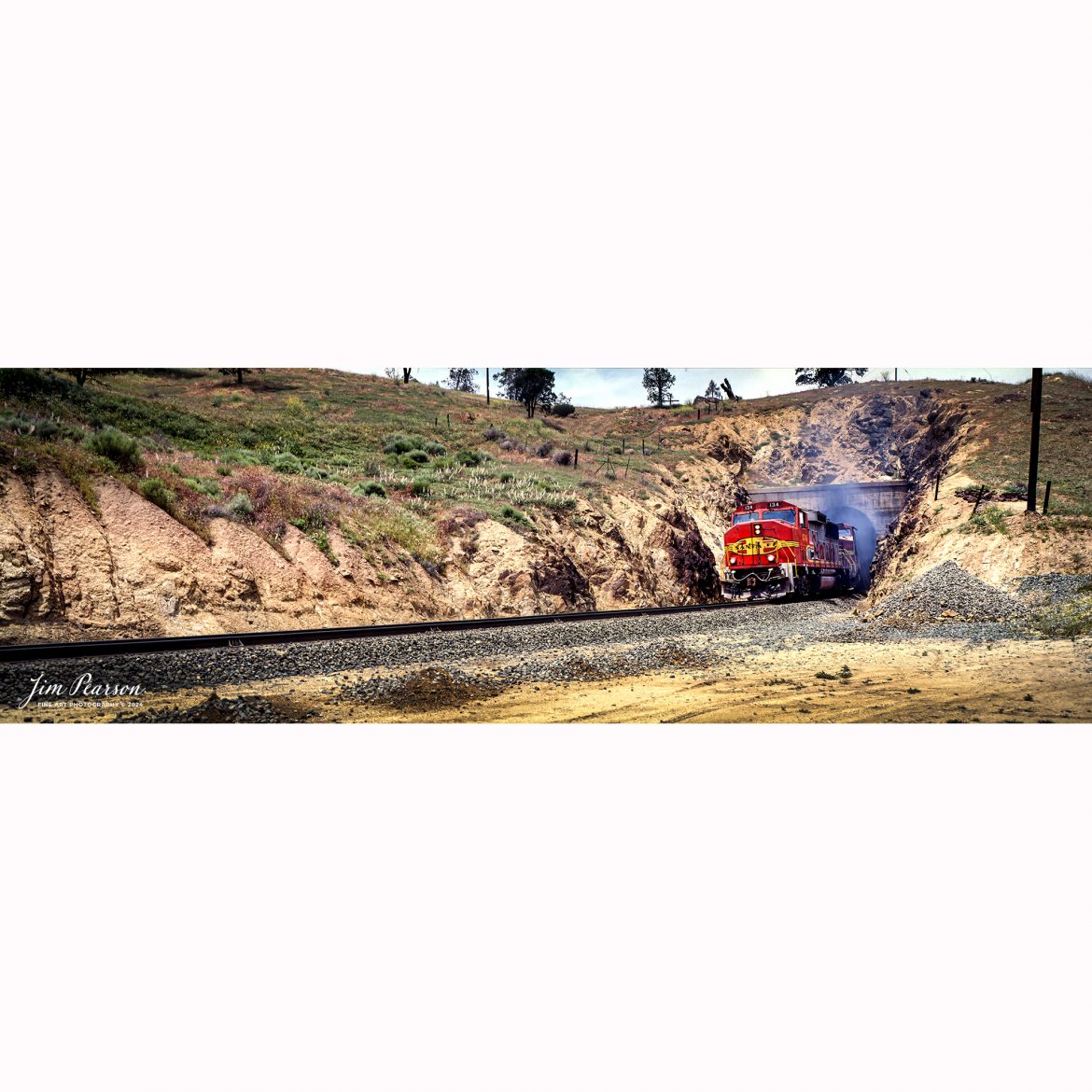
![Film Wednesday – Warbonnet Santa Fe 526 leads a mixed freight as it exits one of the many tunnels in the Tehachapi mountains of California, in this film scan from a 6x17cm slide that was shot sometime in the early 1990’s.
According to Wikipedia: The Atchison, Topeka and Santa Fe Railway (reporting mark ATSF), often referred to as the Santa Fe or AT&SF, was one of the largest Class 1 railroads in the United States between 1859 and 1996.
The Santa Fe was a pioneer in intermodal freight transport; at various times, it operated an airline, the short-lived Santa Fe Skyway, and the Santa Fe Railroad tugboats.[2] Its bus line extended passenger transportation to areas not accessible by rail, and ferryboats on the San Francisco Bay allowed travelers to complete their westward journeys to the Pacific Ocean. The AT&SF was the subject of a popular song, Harry Warren and Johnny Mercer's "On the Atchison, Topeka and the Santa Fe", written for the film The Harvey Girls (1946).
The railroad officially ceased independent operations on December 31, 1996, when it merged with the Burlington Northern Railroad to form the Burlington Northern and Santa Fe Railway.
Tech Info: Camera, Fuji 6x17, Kodachrome Slide Film, no other data recorded, Scanned with an Epson Perfection V700 PHOTO scanner.
#slidescan #filmphotography #trains #railroads #jimpearsonphotography](https://www.jimpearsonphotography.com/wp-content/uploads/2024/12/WEB-1990-SF-6x17-Exits-Tunnel-003-1170x381.jpg)
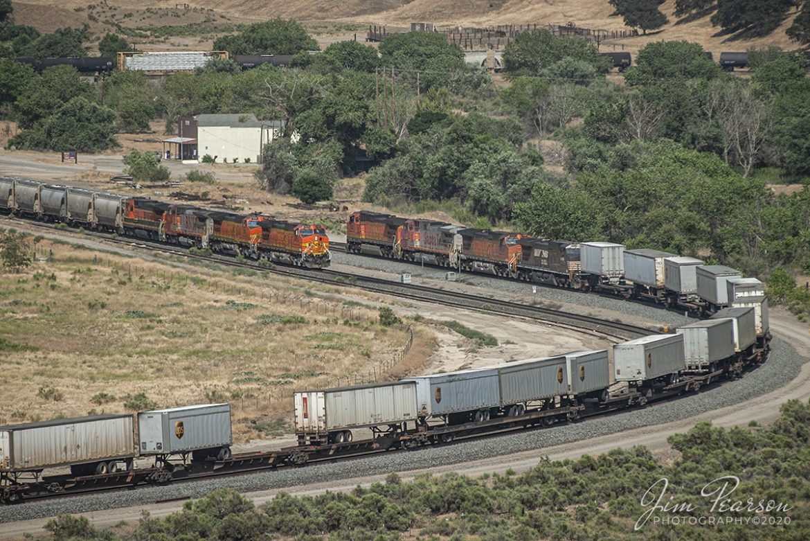

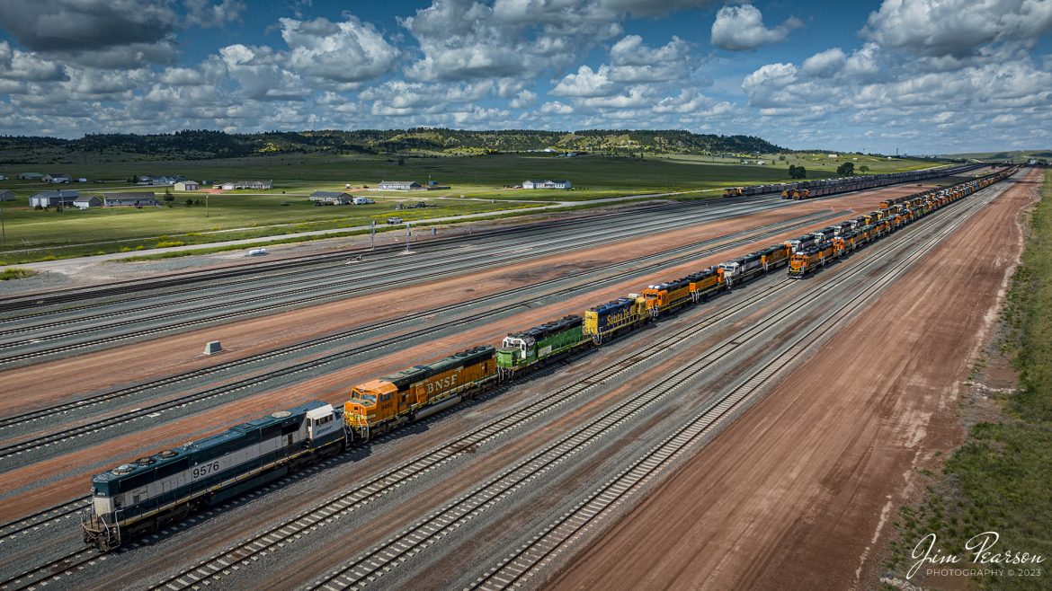
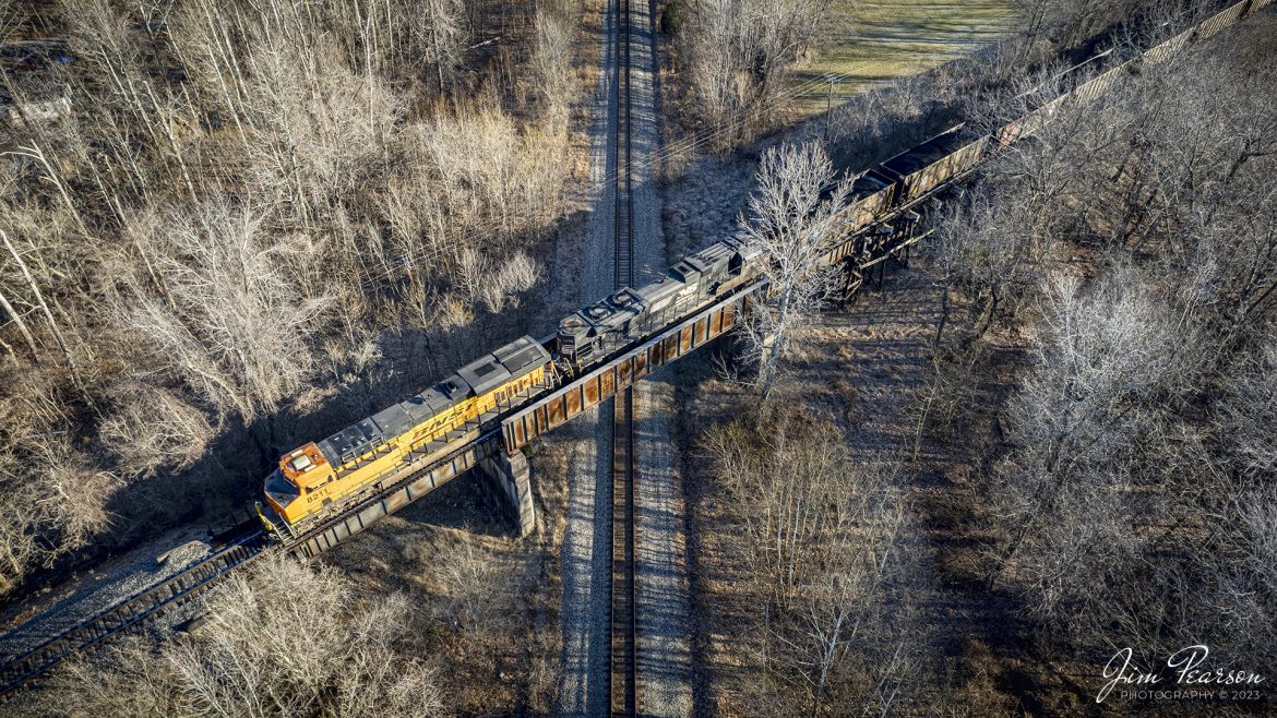
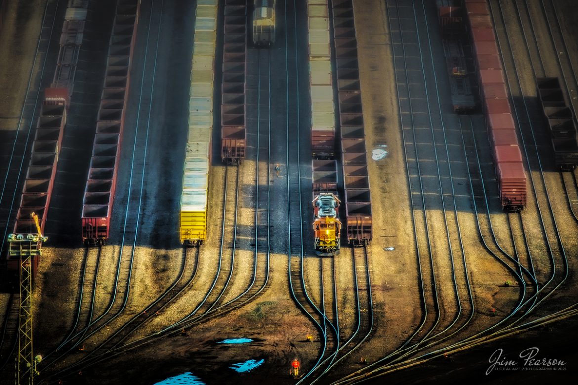
![Santa Fe 5404 leads 8 locomotives as they climb upgrade through the Tehachapi Pass in central California in during early 1995 passing a caboose parked in a house track. Unfortunately I can't remember off the top of my head where this spot is at or what it's called. Anyone know?
According to Wikipedia: Tehachapi Pass (Kawaiisu: Tihachipia, meaning "hard climb") is a mountain pass crossing the Tehachapi Mountains in Kern County, California. Traditionally, the pass marks the northeast end of the Tehachapi’s and the south end of the Sierra Nevada range.
The route is a principal connector between the San Joaquin Valley and the Mojave Desert. The Native American Kitanemuk people used the pass as a trade route before the American settlement of the region in the 19th century. The main line of the former Southern Pacific Railroad opened though the pass in 1876;[4] the tracks are now owned by the Union Pacific Railroad and shared with BNSF Railway as the Mojave Subdivision. U.S. Route 466 was built in the 1930s, and the road is now State Route 58. The Pass is also the route of the planned California High-Speed Rail line.
Tech Notes: Nikon F3 Film Camera, Nikon 300mm, f/stop and shutter speed not recorded
#railroad #railroads #train #trains #bestphoto #railroadengines #picturesoftrains #picturesofrailway #bestphotograph #photographyoftrains #trainphotography #JimPearsonPhotography](https://www.jimpearsonphotography.com/wp-content/uploads/2024/11/WEB-03.1995-SF-5404-in-the-Tehachapi-Pass-1170x762.jpg)
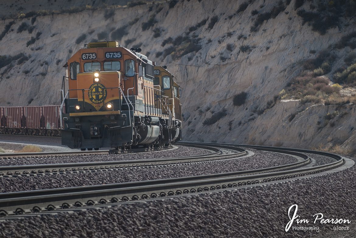

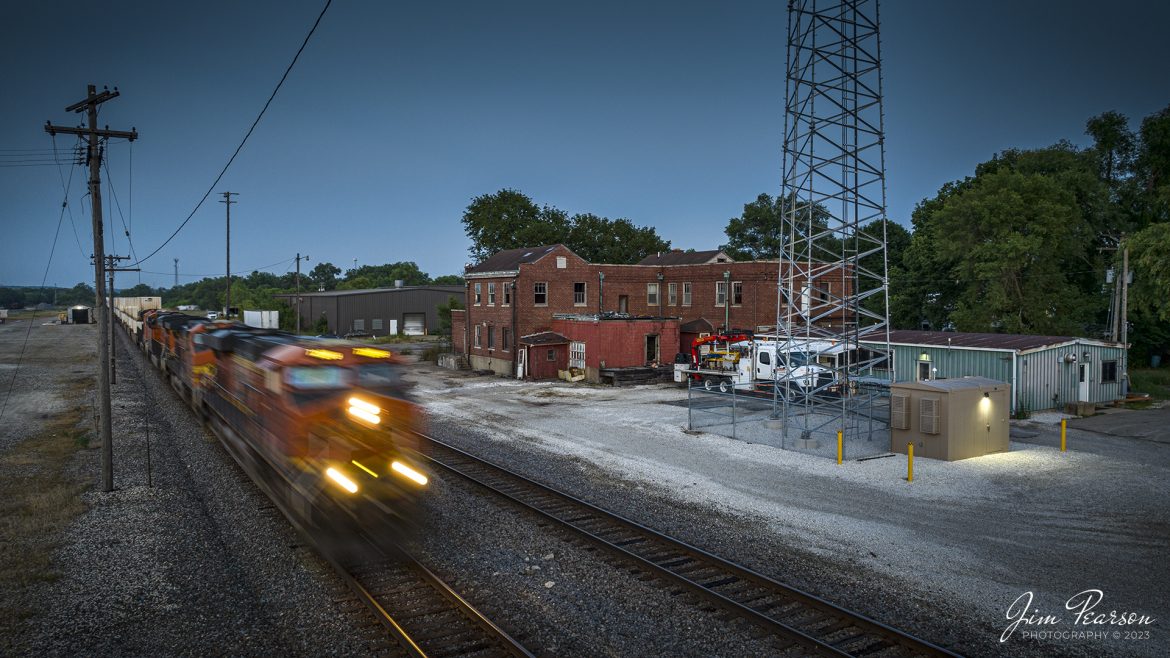
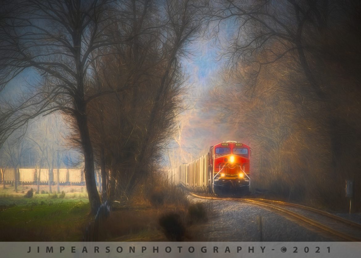
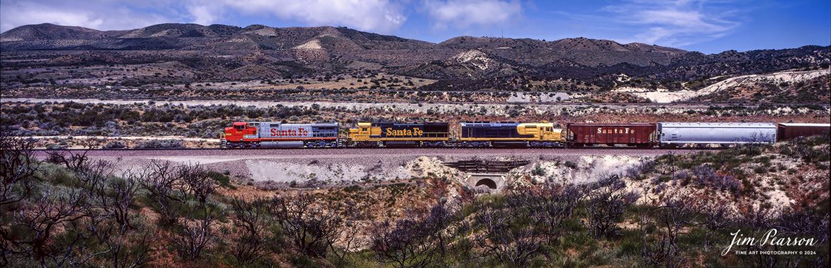
![Santa Fe 947 leads the way as it climbs upgrade through the Tehachapi Pass in northern California in August of 1995.
According to Wikipedia: Tehachapi Pass (Kawaiisu: Tihachipia, meaning "hard climb") is a mountain pass crossing the Tehachapi Mountains in Kern County, California. Traditionally, the pass marks the northeast end of the Tehachapi’s and the south end of the Sierra Nevada range.
The route is a principal connector between the San Joaquin Valley and the Mojave Desert. The Native American Kitanemuk people used the pass as a trade route before the American settlement of the region in the 19th century. The main line of the former Southern Pacific Railroad opened though the pass in 1876;[4] the tracks are now owned by the Union Pacific Railroad and shared with BNSF Railway as the Mojave Subdivision. U.S. Route 466 was built in the 1930s, and the road is now State Route 58. The Pass is also the route of the planned California High-Speed Rail line.
Tech Notes: Nikon F3 Film Camera, Nikon 300mm, f/stop and shutter speed not recorded
#railroad #railroads #train #trains #bestphoto #railroadengines #picturesoftrains #picturesofrailway #bestphotograph #photographyoftrains #trainphotography #JimPearsonPhotography](https://www.jimpearsonphotography.com/wp-content/uploads/2024/05/WEB-08.1995-SF-947-climbs-the-grade-in-Tehachapi-Pass.jpg)