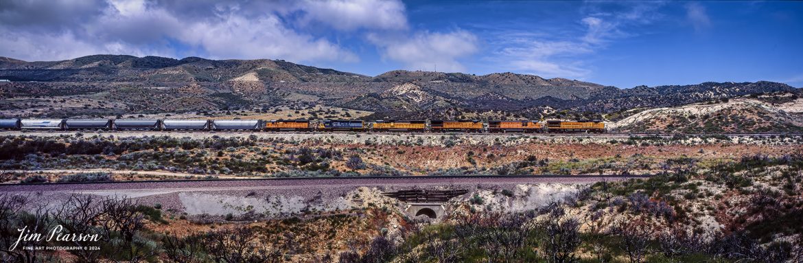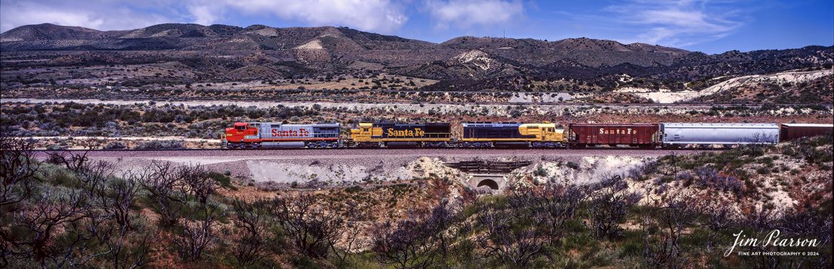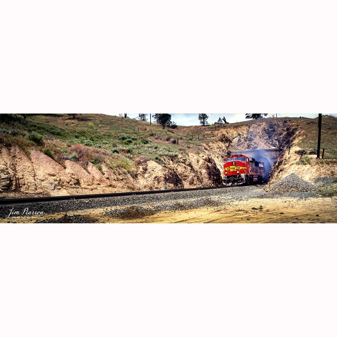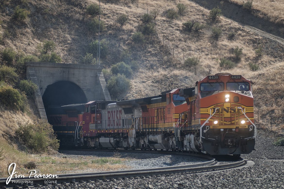
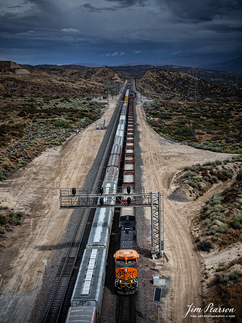
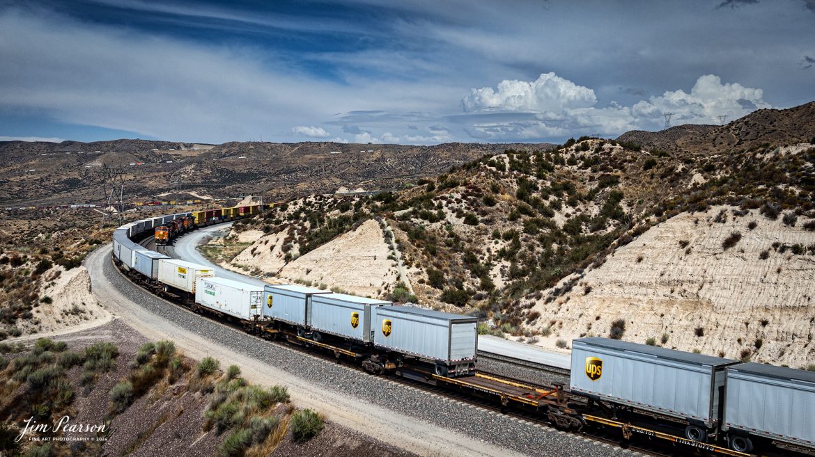
September 20th, 2024, A BNSF freight and a BNSF rock train pass each other at the Summit of Cajon Pass in southern California and the BNSF Cajon Subdivision.
According to Wikipedia: Cajon Pass is a mountain pass between the San Bernardino Mountains to the east and the San Gabriel Mountains to the west in Southern California. Created by the movements of the San Andreas Fault, it has an elevation of 3,777 ft (1,151 m). Located in the Mojave Desert, the pass is an important link from the Greater San Bernardino Area to the Victor Valley, and northeast to Las Vegas. The Cajon Pass area is on the Pacific Crest Trail.
Cajon Pass is at the head of Horsethief Canyon, traversed by California State Route 138 (SR 138) and railroad tracks owned by BNSF Railway and Union Pacific Railroad. Improvements in 1972 reduced the railroad’s maximum elevation from about 3,829 to 3,777 feet while reducing curvature. Interstate 15 does not traverse Cajon Pass, but rather the nearby Cajon Summit. The entire area, Cajon Pass and Cajon Summit, is often referred to as Cajon Pass, but a distinction is made between Cajon Pass and Cajon Summit.
The California Southern Railroad, a subsidiary of the Atchison, Topeka and Santa Fe Railway, was the first railroad through Cajon Pass. The line through the pass was built in the early 1880s to connect the present-day cities of Barstow and San Diego. Today the Union Pacific Railroad and BNSF Railway (the successor to the Santa Fe) use the pass to reach Los Angeles and San Bernardino as part of the Southern Transcon. Due to the many trains, scenery and easy access, it is a popular location for railfans, and many photographs of trains on Cajon Pass appear in books and magazines.
Tech Info: DJI Mavic 3 Classic Drone, RAW, 24mm, f/2.8, 1/1600, ISO 100.
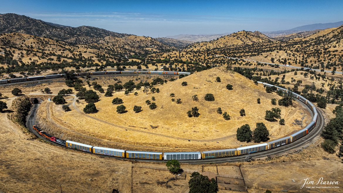
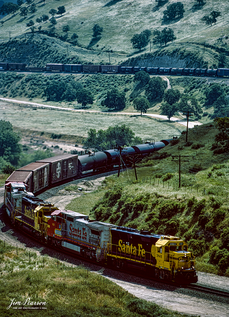
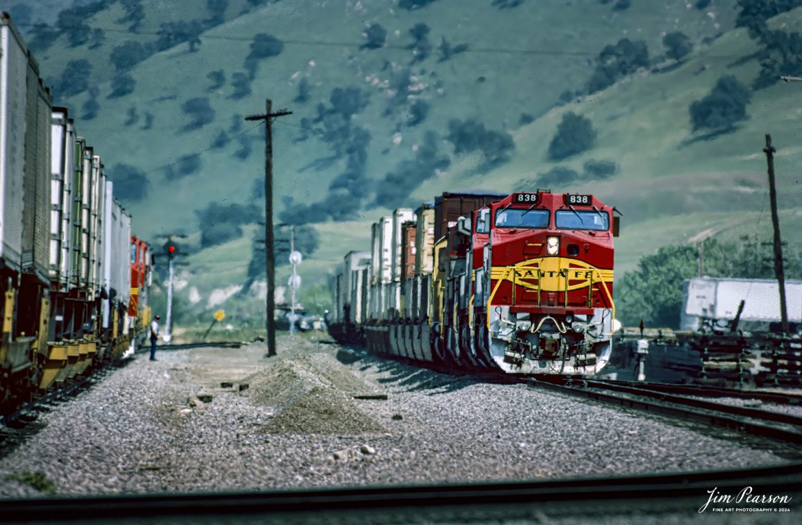
![Film Wednesday – Five Santa Fe Warbonnet units lead a loaded intermodal as it approaches one of the many tunnels in the Tehachapi mountains of California that was shot sometime in the mid 1990’s.
According to Wikipedia: The Atchison, Topeka and Santa Fe Railway (reporting mark ATSF), often referred to as the Santa Fe or AT&SF, was one of the largest Class 1 railroads in the United States between 1859 and 1996.
The Santa Fe was a pioneer in intermodal freight transport; at various times, it operated an airline, the short-lived Santa Fe Skyway, and the Santa Fe Railroad tugboats.[2] Its bus line extended passenger transportation to areas not accessible by rail, and ferryboats on the San Francisco Bay allowed travelers to complete their westward journeys to the Pacific Ocean. The AT&SF was the subject of a popular song, Harry Warren and Johnny Mercer's "On the Atchison, Topeka and the Santa Fe", written for the film The Harvey Girls (1946).
The railroad officially ceased independent operations on December 31, 1996, when it merged with the Burlington Northern Railroad to form the Burlington Northern and Santa Fe Railway.
Tech Info: Camera, Nikon F3, Kodachrome Slide Film, no other data recorded
#slidescan #filmphotography #trains #railroads #jimpearsonphotography](https://www.jimpearsonphotography.com/wp-content/uploads/2025/01/WEB-1995-KR-Slide-SF-in-Techachapi-1-1170x748.jpg)
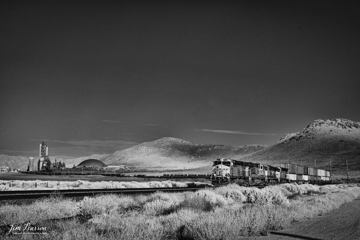
![Film Wednesday – Warbonnet Santa Fe 526 leads a mixed freight as it exits one of the many tunnels in the Tehachapi mountains of California, in this film scan from a 6x17cm slide that was shot sometime in the early 1990’s.
According to Wikipedia: The Atchison, Topeka and Santa Fe Railway (reporting mark ATSF), often referred to as the Santa Fe or AT&SF, was one of the largest Class 1 railroads in the United States between 1859 and 1996.
The Santa Fe was a pioneer in intermodal freight transport; at various times, it operated an airline, the short-lived Santa Fe Skyway, and the Santa Fe Railroad tugboats.[2] Its bus line extended passenger transportation to areas not accessible by rail, and ferryboats on the San Francisco Bay allowed travelers to complete their westward journeys to the Pacific Ocean. The AT&SF was the subject of a popular song, Harry Warren and Johnny Mercer's "On the Atchison, Topeka and the Santa Fe", written for the film The Harvey Girls (1946).
The railroad officially ceased independent operations on December 31, 1996, when it merged with the Burlington Northern Railroad to form the Burlington Northern and Santa Fe Railway.
Tech Info: Camera, Fuji 6x17, Kodachrome Slide Film, no other data recorded, Scanned with an Epson Perfection V700 PHOTO scanner.
#slidescan #filmphotography #trains #railroads #jimpearsonphotography](https://www.jimpearsonphotography.com/wp-content/uploads/2024/12/WEB-1990-SF-6x17-Exits-Tunnel-003-1170x381.jpg)