September 18th, 2024, In this Saturday’s Infrared photo I caught BNSF 6965 leading an Northbound intermodal train out of Tehachapi, California.
Tech Info: Fuji XT1 converted to Infrared, RAW, Nikon 24-70, @35mm, f/4, 1/640, ISO 200.
September 18th, 2024, In this Saturday’s Infrared photo I caught BNSF 6965 leading an Northbound intermodal train out of Tehachapi, California.
Tech Info: Fuji XT1 converted to Infrared, RAW, Nikon 24-70, @35mm, f/4, 1/640, ISO 200.
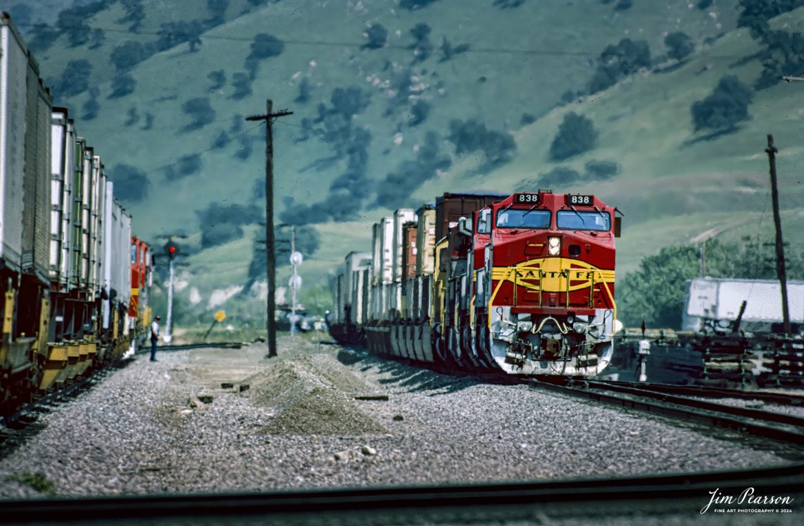
April, 1995 – Blast From The Past – It was a hot, dry day as a Piggyback with SF 838 leading met a northbound, piggyback at Caliente, California, as they make their way through the Tehachapi Mountains on the UP Mojave Subdivision toward Bakersfield, CA, while the conductor on the waiting train does a roll-by inspection.
Thinking of visiting this area? Check out this page on the web!
http://www.trainweb.org/brettrw/maps/caliente.htm
Tech Info: Nikon D200, Nikon 70-300 @300mm, Ektachrome Slide Film, 1/1250, f/5.6, ISO 100.
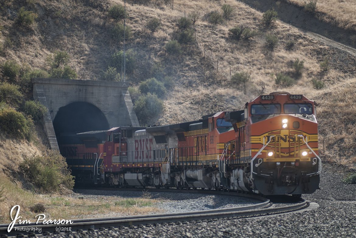
June 23, 2006 – BNSF 4439 pulls a freight though one of the many tunnels in the Tehachapi Mountains, outside Bakersfield, CA with a rainbow of power.
Tech Info: Nikon D200, Nikon 70-300 @ 95mm, RAW, 1/640, f/4, ISO 100.
June 23, 2006 – Blast From The Past – It was a hot, dry day as a Piggyback with BNSF 5232 leading headed east, meeting a Mixed freight headed up by BNSF 4438 waiting to head west toward Bakersfield, in horseshoe curve in the valley at Caliente, California as they made their way through the Tehachapi Mountains on the UP Mojave Subdivision.
Thinking of visiting this area? Check out this page on the web!
http://www.trainweb.org/brettrw/maps/caliente.htm
Tech Info: Nikon D200, Nikon 70-300 @200mm, RAW, 1/1250, f/5.6, ISO 100.
![Santa Fe 5404 leads 8 locomotives as they climb upgrade through the Tehachapi Pass in central California in during early 1995 passing a caboose parked in a house track. Unfortunately I can't remember off the top of my head where this spot is at or what it's called. Anyone know?
According to Wikipedia: Tehachapi Pass (Kawaiisu: Tihachipia, meaning "hard climb") is a mountain pass crossing the Tehachapi Mountains in Kern County, California. Traditionally, the pass marks the northeast end of the Tehachapi’s and the south end of the Sierra Nevada range.
The route is a principal connector between the San Joaquin Valley and the Mojave Desert. The Native American Kitanemuk people used the pass as a trade route before the American settlement of the region in the 19th century. The main line of the former Southern Pacific Railroad opened though the pass in 1876;[4] the tracks are now owned by the Union Pacific Railroad and shared with BNSF Railway as the Mojave Subdivision. U.S. Route 466 was built in the 1930s, and the road is now State Route 58. The Pass is also the route of the planned California High-Speed Rail line.
Tech Notes: Nikon F3 Film Camera, Nikon 300mm, f/stop and shutter speed not recorded
#railroad #railroads #train #trains #bestphoto #railroadengines #picturesoftrains #picturesofrailway #bestphotograph #photographyoftrains #trainphotography #JimPearsonPhotography](https://www.jimpearsonphotography.com/wp-content/uploads/2024/11/WEB-03.1995-SF-5404-in-the-Tehachapi-Pass-1170x762.jpg)
Santa Fe 5404 leads 8 locomotives as they climb upgrade through the Tehachapi Pass in central California in during early 1995 passing a caboose parked in a house track. Unfortunately I can’t remember off the top of my head where this spot is at or what it’s called. Anyone know?
According to Wikipedia: Tehachapi Pass (Kawaiisu: Tihachipia, meaning “hard climb”) is a mountain pass crossing the Tehachapi Mountains in Kern County, California. Traditionally, the pass marks the northeast end of the Tehachapi’s and the south end of the Sierra Nevada range.
The route is a principal connector between the San Joaquin Valley and the Mojave Desert. The Native American Kitanemuk people used the pass as a trade route before the American settlement of the region in the 19th century. The main line of the former Southern Pacific Railroad opened though the pass in 1876;[4] the tracks are now owned by the Union Pacific Railroad and shared with BNSF Railway as the Mojave Subdivision. U.S. Route 466 was built in the 1930s, and the road is now State Route 58. The Pass is also the route of the planned California High-Speed Rail line.
Tech Notes: Nikon F3 Film Camera, Nikon 300mm, f/stop and shutter speed not recorded
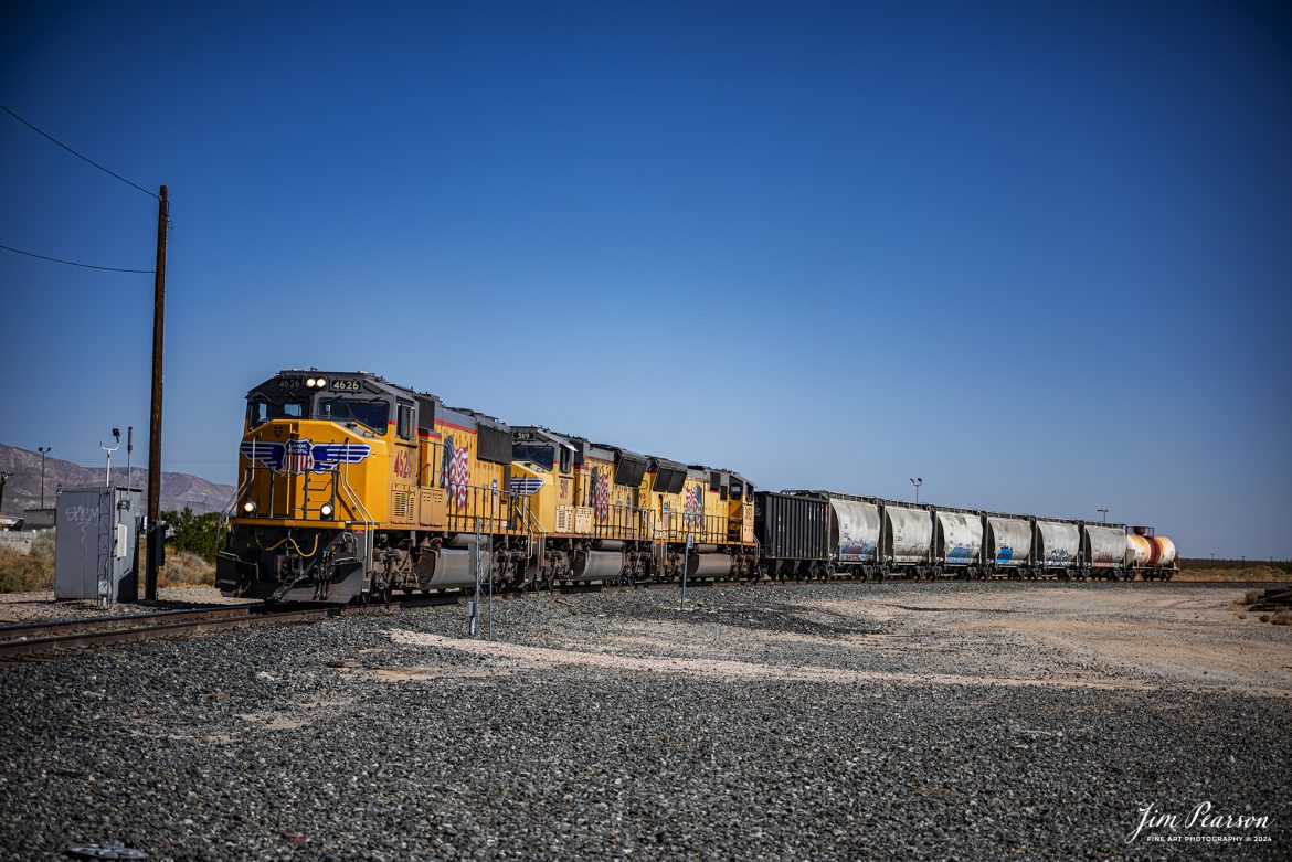
September 18th, 2024, Union Pacific 4626 leads a local as it heads back to the yard at Mojave, California, off the Union Pacific Lone Pine Subdivision.
Tech Info: Nikon D810, RAW, Nikon 70-300 @ 70mm, f/4.5, 1/640, ISO 64.
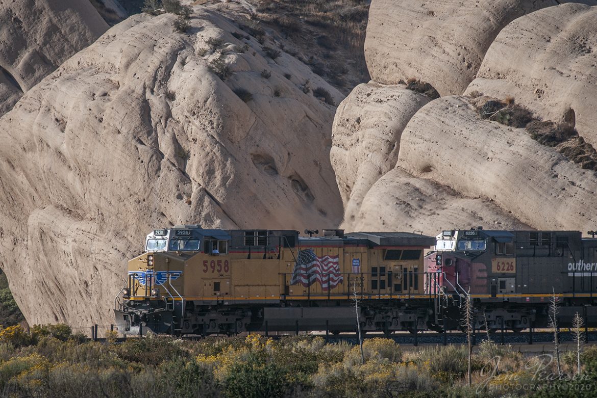
October 20, 2008 – The late evening light rakes across the base of Mormon Rocks as UP 5958 and 6266 (ex-Southern Pacific Unit) lead a west bound freight down the Cajon Pass in southern California.
Local legend has it that the rocks were named for the Mormon pioneers who camped here after their descent from the pass ridgeline. Another legend calls the rocks the ‘Chanting Rocks,’ as when the wind would blow across the portholes in the rocks it was said the sound made was similar to a low chanting or singing.
Nikon D300, Nikon 70-300 @ 300mm, 1/640, f/8, ISO 200, RAW.
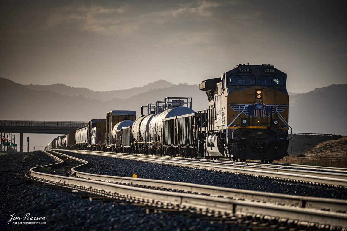
September 18th, 2024, Union Pacific 7228 brings up the rear as a DPU on a southbound freight headed into Tehachapi, California, on the Union Pacific Mojave Subdivision on a beautiful summer evening.
Tech Info: Nikon D810, RAW, Nikon 70-300 @ 240mm, f/5.6, 1/640, ISO 90.
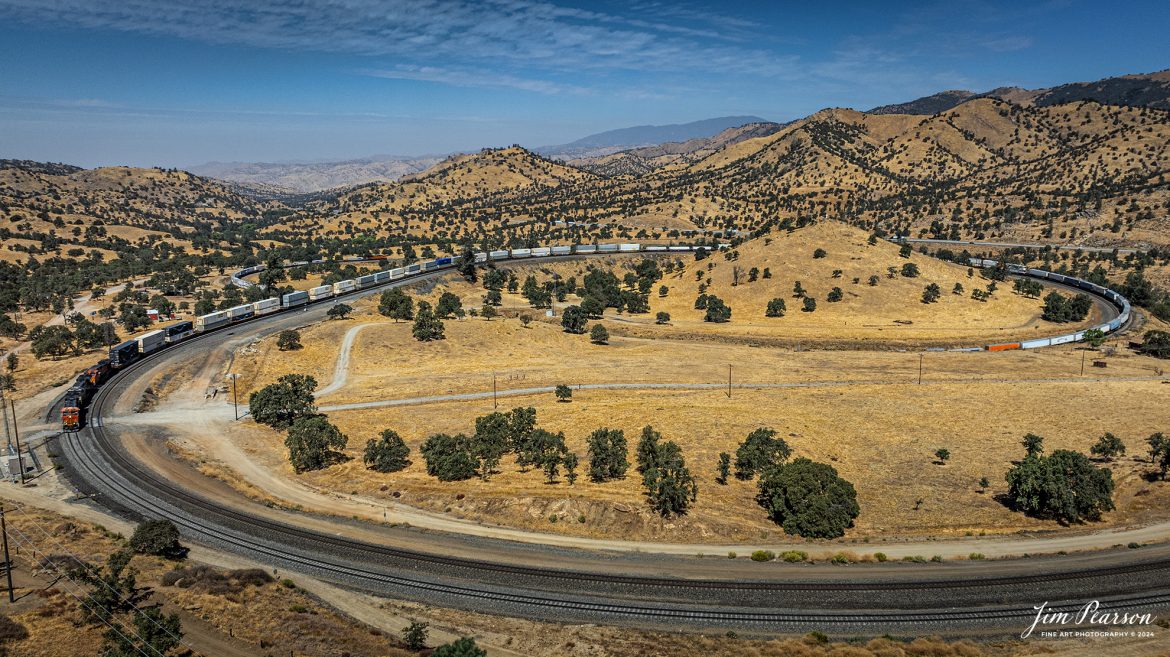
September 18th, 2024, BNSF 8057, NS 8068 and BNSF 5177 lead an eastbound train through the famous Tehachapi Loop on the Union Pacific Mojave Subdivision at Keene, California.
According to Wikipedia: The Tehachapi Loop is a 3,779-foot-long (0.72 mi; 1.15 km) spiral, or helix, on the Union Pacific Railroad Mojave Subdivision through Tehachapi Pass, of the Tehachapi Mountains in Kern County, south-central California. The line connects Bakersfield and the San Joaquin Valley to Mojave in the Mojave Desert.
Rising at a steady two-percent grade, the track gains 77 feet (23 m) in elevation and makes a 1,210-foot-diameter (370 m) circle. Any train that is more than 3,800 feet (1,200 m) long—about 56 boxcars—passes over itself going around the loop. At the bottom of the loop, the track passes through Tunnel 9, the ninth tunnel built as the railroad was extended from Bakersfield.
The line averages about 36 freight trains each day. Passenger trains such as Amtrak’s San Joaquin are banned from the loop, although the Coast Starlight can use it as a detour. Its frequent trains and scenic setting make the Tehachapi Loop popular with railfans. In 1998, it was named a National Historic Civil Engineering Landmark. It is also designated as California Historical Landmark #508.
One of the engineering feats of its day, the Loop was built by Southern Pacific Railroad to ease the grade over Tehachapi Pass. Construction began in 1874, and the line opened in 1876.
Tech Info: DJI Mavic 3 Classic Drone, RAW, 24mm, f/2.8, 1/2500, ISO 100.
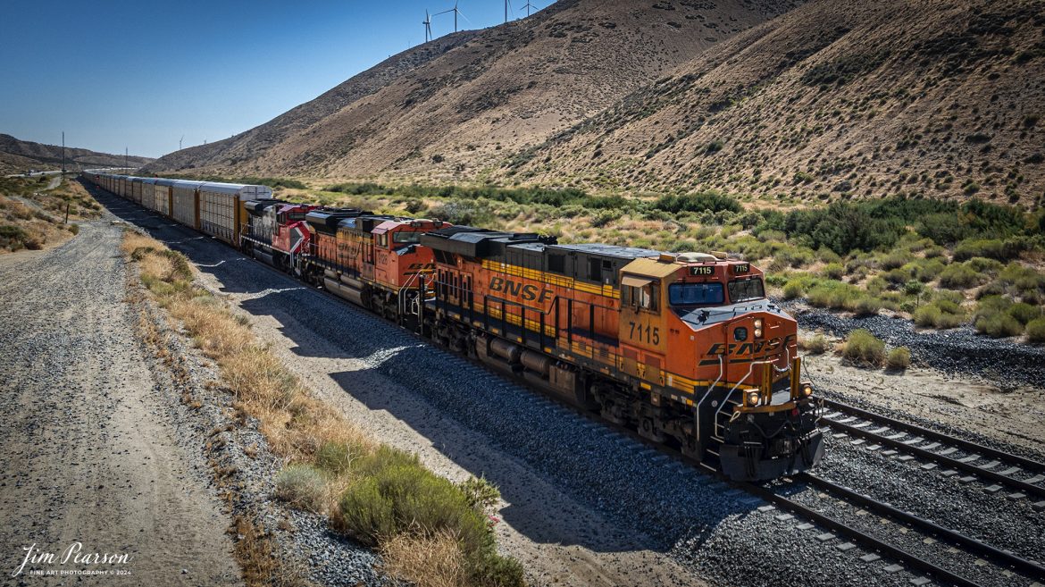
September 18th, 2024, BNSF 7115, 9128 and Ferromex 4050 lead an southbound train as they head toward Tehachapi Loop on the Union Pacific Mojave Subdivision at from Tehachapi, California.
Tech Info: DJI Mavic 3 Classic Drone, RAW, 24mm, f/2.8, 1/2500, ISO 110.
September 19th, 2024, BNSF freight train heads north through the mountains after passing through the Tehachapi the loop at Woodford, California, on the Union Pacific Mojave Subdivision.
Tech Info: DJI Mavic 3 Classic Drone, RAW, 24mm, f/2.8, 1/2000, ISO 100.
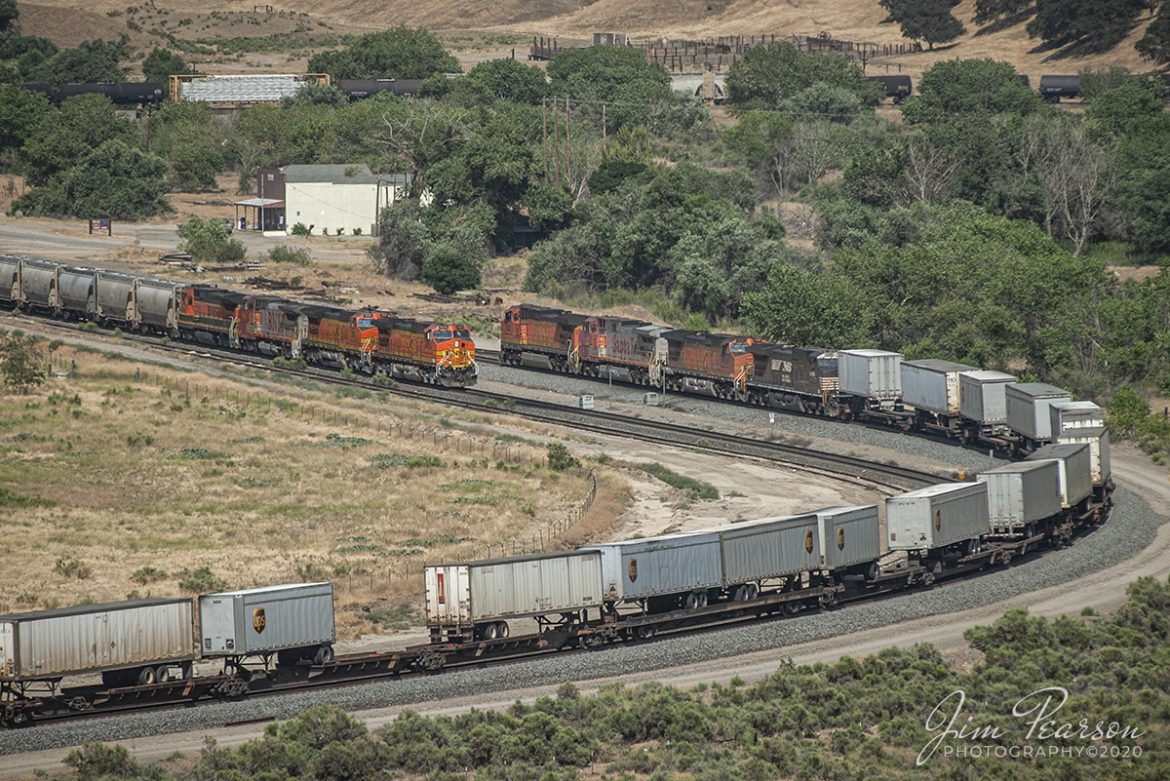
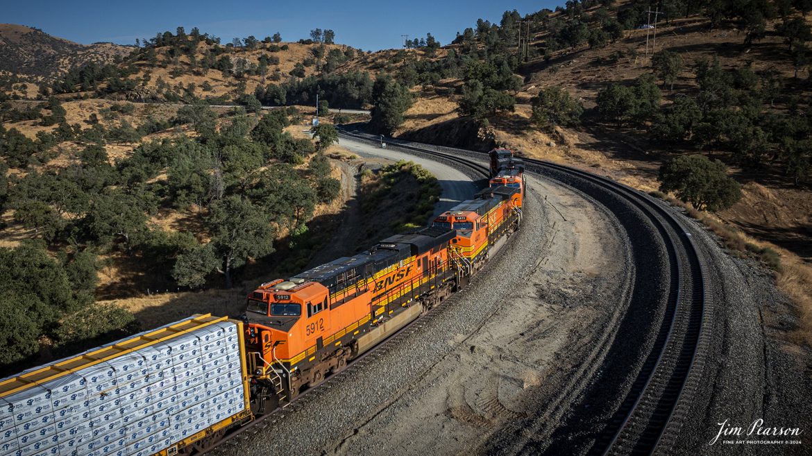
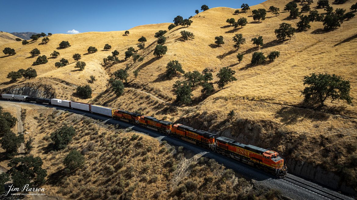
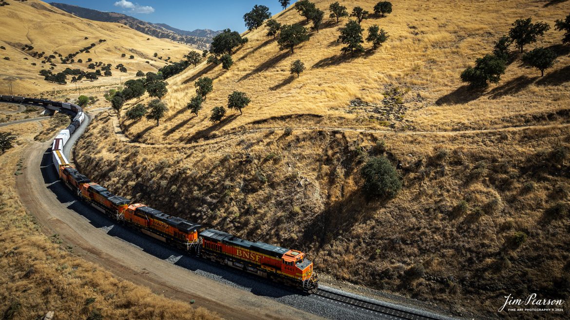
September 18th, 2024, A BNSF northbound train works its way out of the horseshoe curve on the Union Pacific Mojave Subdivision at Caliente, California, starting their climb up through the Tehachapi Pass.
According to Wikipedia: Established in the 1870s, Caliente was originally named Allens Camp for a cattle rancher and settler named Gabriel Allen. Later, the name Agua Caliente, coming from hot springs in the area, was proposed and may have been used. This name conflicted with the community of the same name in Sonoma County. With the railroad’s arrival in 1875, the shortened name Caliente was adopted.
Caliente prospered during Southern Pacific Railroad’s construction of Tehachapi Pass line. For a time, the Telegraph Stage Line and the Cerro Gordo Freighting Co. also ran through Caliente and its full-time population grew to 200. There were approximately 60 buildings, including 20 or more saloons.
Tech Info: DJI Mavic 3 Classic Drone, RAW, 24mm, f/2.8, 1/1600, ISO 100.
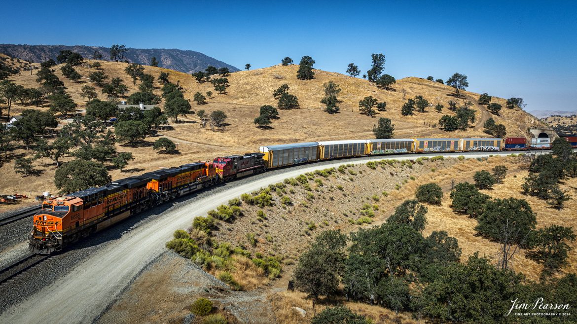
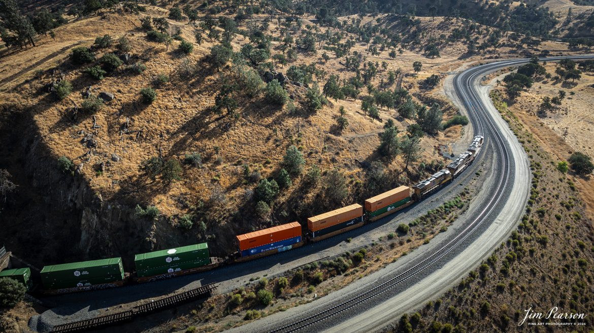
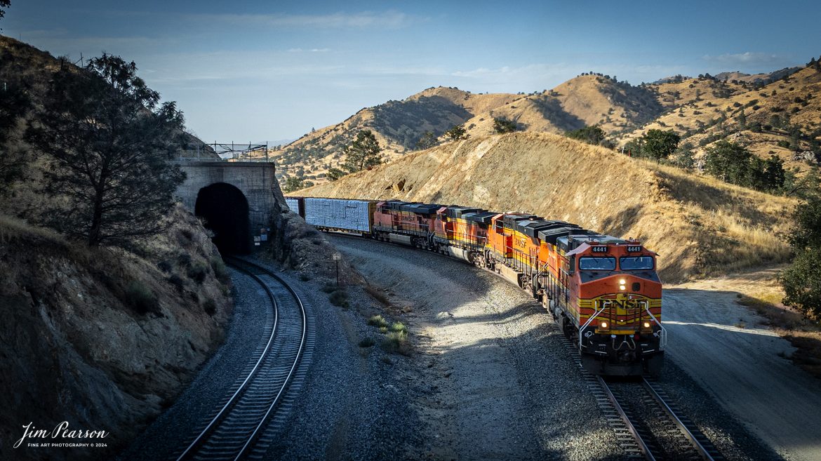
September 18th, 2024, BNSF 4441 leads an northbound freight train after they skirt around tunnel 10 from Tehachapi Loop on the Union Pacific Mojave Subdivision at, Woodford, California.
According to Wikipedia: The Tehachapi Loop is a 3,779-foot-long (0.72 mi; 1.15 km) spiral, or helix, on the Union Pacific Railroad Mojave Subdivision through Tehachapi Pass, of the Tehachapi Mountains in Kern County, south-central California. The line connects Bakersfield and the San Joaquin Valley to Mojave in the Mojave Desert.
Rising at a steady two-percent grade, the track gains 77 feet (23 m) in elevation and makes a 1,210-foot-diameter (370 m) circle. Any train that is more than 3,800 feet (1,200 m) long—about 56 boxcars—passes over itself going around the loop. At the bottom of the loop, the track passes through Tunnel 9, the ninth tunnel built as the railroad was extended from Bakersfield.
The line averages about 36 freight trains each day. Passenger trains such as Amtrak’s San Joaquin are banned from the loop, although the Coast Starlight can use it as a detour. Its frequent trains and scenic setting make the Tehachapi Loop popular with railfans. In 1998, it was named a National Historic Civil Engineering Landmark. It is also designated as California Historical Landmark #508.
One of the engineering feats of its day, the Loop was built by Southern Pacific Railroad to ease the grade over Tehachapi Pass. Construction began in 1874, and the line opened in 1876.
Tech Info: DJI Mavic 3 Classic Drone, RAW, 24mm, f/2.8, 1/2500, ISO 150.
September 18th, 2024, Union Pacific 5533 leads an southbound intermodal train as they exit tunnel 10 and head into Tehachapi Loop on the Union Pacific Mojave Subdivision at Woodford, California.
According to Wikipedia: The Tehachapi Loop is a 3,779-foot-long (0.72 mi; 1.15 km) spiral, or helix, on the Union Pacific Railroad Mojave Subdivision through Tehachapi Pass, of the Tehachapi Mountains in Kern County, south-central California. The line connects Bakersfield and the San Joaquin Valley to Mojave in the Mojave Desert.
Rising at a steady two-percent grade, the track gains 77 feet (23 m) in elevation and makes a 1,210-foot-diameter (370 m) circle. Any train that is more than 3,800 feet (1,200 m) long—about 56 boxcars—passes over itself going around the loop. At the bottom of the loop, the track passes through Tunnel 9, the ninth tunnel built as the railroad was extended from Bakersfield.
The line averages about 36 freight trains each day. Passenger trains such as Amtrak’s San Joaquin are banned from the loop, although the Coast Starlight can use it as a detour. Its frequent trains and scenic setting make the Tehachapi Loop popular with railfans. In 1998, it was named a National Historic Civil Engineering Landmark. It is also designated as California Historical Landmark #508.
One of the engineering feats of its day, the Loop was built by Southern Pacific Railroad to ease the grade over Tehachapi Pass. Construction began in 1874, and the line opened in 1876.
Tech Info: DJI Mavic 3 Classic Drone, RAW, 24mm, f/2.8, 1/800, ISO 110.
September 19th, 2024, BNSF tank train heads south through the mountains toward Tehachapi the loop at Woodford, California, on the Union Pacific Mojave Subdivision.
Tech Info: DJI Mavic 3 Classic Drone, RAW, 24mm, f/2.8, 1/4000, ISO 200.
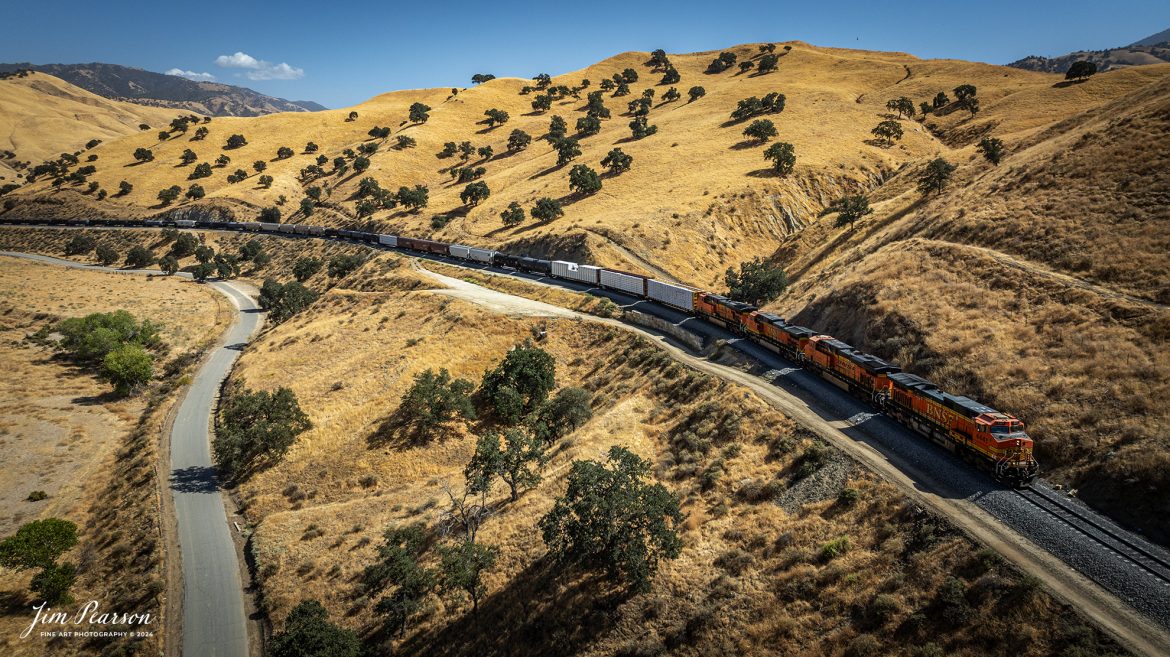
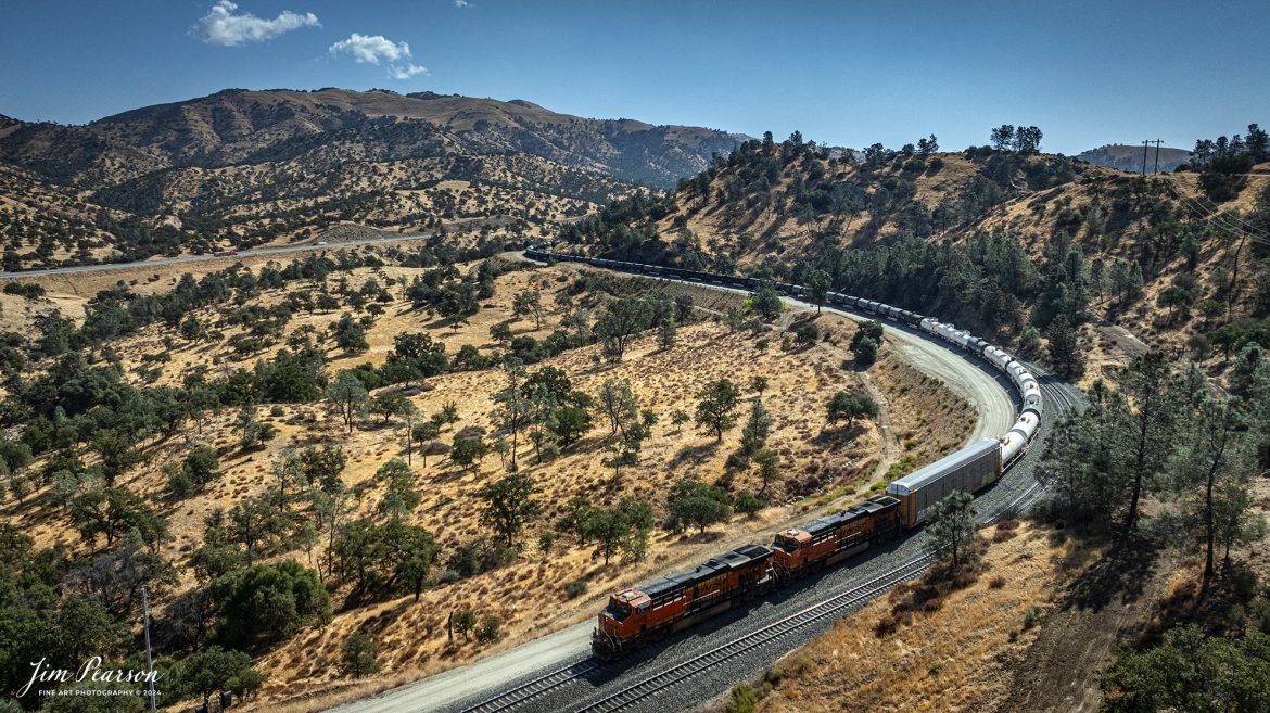
September 18th, 2024, BNSF mixed freight heads north through the mountains toward Tehachapi, California, on the Union Pacific Mojave Subdivision on a beautiful summer evening.
Tech Info: DJI Mavic 3 Classic Drone, RAW, 24mm, f/2.8, 1/1600, ISO 110.
September 18th, 2024, A BNSF northbound train works its way out of the horseshoe curve on the Union Pacific Mojave Subdivision at Caliente, California, starting their climb up through the Tehachapi Pass.
According to Wikipedia: Established in the 1870s, Caliente was originally named Allens Camp for a cattle rancher and settler named Gabriel Allen. Later, the name Agua Caliente, coming from hot springs in the area, was proposed and may have been used. This name conflicted with the community of the same name in Sonoma County. With the railroad’s arrival in 1875, the shortened name Caliente was adopted.
Caliente prospered during Southern Pacific Railroad’s construction of Tehachapi Pass line. For a time, the Telegraph Stage Line and the Cerro Gordo Freighting Co. also ran through Caliente and its full-time population grew to 200. There were approximately 60 buildings, including 20 or more saloons.
Tech Info: DJI Mavic 3 Classic Drone, RAW, 24mm, f/2.8, 1/1600, ISO 100.
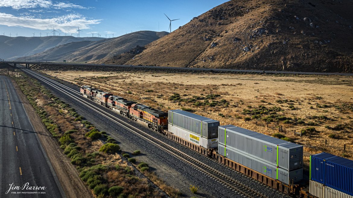
September 19th, 2024, BNSF intermodal heads north out of Tehachapi, California, on the Union Pacific Mojave Subdivision on a beautiful summer evening.
Tech Info: DJI Mavic 3 Classic Drone, RAW, 24mm, f/2.8, 1/2500, ISO 150.
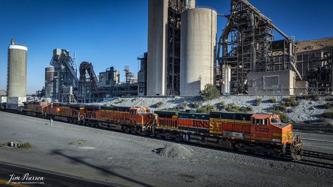
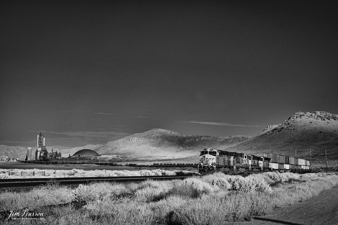
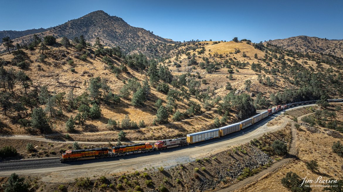
September 18th, 2024, BNSF 5320 leads a southbound freight past the cement plant in Tehachapi, California, on the Union Pacific Mojave Subdivision on a beautiful summer evening.
Tech Info: Nikon D810, RAW, Nikon 10-24 @ 12mm, f/5.6, 1/1250, ISO 100.
September 18th, 2024, BNSF 4441 leads an northbound freight train as they skirt around tunnel 10 from Tehachapi Loop on the Union Pacific Mojave Subdivision at, Woodford, California.
According to Wikipedia: The Tehachapi Loop is a 3,779-foot-long (0.72 mi; 1.15 km) spiral, or helix, on the Union Pacific Railroad Mojave Subdivision through Tehachapi Pass, of the Tehachapi Mountains in Kern County, south-central California. The line connects Bakersfield and the San Joaquin Valley to Mojave in the Mojave Desert.
Rising at a steady two-percent grade, the track gains 77 feet (23 m) in elevation and makes a 1,210-foot-diameter (370 m) circle. Any train that is more than 3,800 feet (1,200 m) long—about 56 boxcars—passes over itself going around the loop. At the bottom of the loop, the track passes through Tunnel 9, the ninth tunnel built as the railroad was extended from Bakersfield.
The line averages about 36 freight trains each day. Passenger trains such as Amtrak’s San Joaquin are banned from the loop, although the Coast Starlight can use it as a detour. Its frequent trains and scenic setting make the Tehachapi Loop popular with railfans. In 1998, it was named a National Historic Civil Engineering Landmark. It is also designated as California Historical Landmark #508.
One of the engineering feats of its day, the Loop was built by Southern Pacific Railroad to ease the grade over Tehachapi Pass. Construction began in 1874, and the line opened in 1876.
Tech Info: DJI Mavic 3 Classic Drone, RAW, 24mm, f/2.8, 1/1600, ISO 290.
September 18th, 2024, A BNSF northbound train works its way out of the horseshoe curve on the Union Pacific Mojave Subdivision at Caliente, California, starting their climb up through the Tehachapi Pass.
According to Wikipedia: Established in the 1870s, Caliente was originally named Allens Camp for a cattle rancher and settler named Gabriel Allen. Later, the name Agua Caliente, coming from hot springs in the area, was proposed and may have been used. This name conflicted with the community of the same name in Sonoma County. With the railroad’s arrival in 1875, the shortened name Caliente was adopted.
Caliente prospered during Southern Pacific Railroad’s construction of Tehachapi Pass line. For a time, the Telegraph Stage Line and the Cerro Gordo Freighting Co. also ran through Caliente and its full-time population grew to 200. There were approximately 60 buildings, including 20 or more saloons.
Tech Info: DJI Mavic 3 Classic Drone, RAW, 24mm, f/2.8, 1/1600, ISO 100.